Live

 23:51:10
 23.8°C / 74.8°F
 Scattered Clouds
 65%
65% 7 km/h / 4 mph
 08:00
08:00 19:36
19:36Loading forecast…
Sierra Norte de Madrid, Community of Madrid, Spain
 16.7°C / 62.1°F
00:51
16.7°C / 62.1°F
00:51
Playa del Albir, L'Alfas del Pi, Alicante, Spain
20.4°C / 68.7°F
00:51




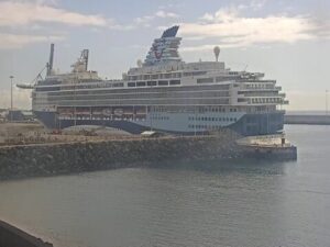
Cruise Pirs Arrecife, Avenida de los Marmoles, Arrecife, Spain
23.1°C / 73.6°F
23:51
The Maspalomas Webcam is a rotating live stream from the south coast of Gran Canaria that cycles through four cameras: the Maspalomas dunes, the sand of Playa de Maspalomas, a hillside view over Meloneras toward Pasito Blanco, and a fourth camera in Arinaga on the island’s east coast. Each view usually stays on screen for about a minute and a half before the next takes over, so one full loop runs roughly six minutes. The dunes camera looks over rippled sand and clumps of scrub to a row of red parasols and the Atlantic beyond. The beach camera sits behind a line of white parasols on the sand, while the Meloneras camera pans from the brown mountains inland, over villa roofs and golf greens, out to open sea.
Maspalomas is the southernmost part of the municipality of San Bartolome de Tirajana, with a population of 36,065 in 2013. The resort as it stands today grew out of an international ideas contest held in 1961, which planned tourist development over 1,060 hectares (2,600 acres) and 19 kilometers (12 miles) of coast. The name now covers a run of resort districts from San Agustin and Playa del Ingles in the east to Meloneras at the western edge.
The dunes are the reason most people search for the place. In 1994 about 4 square kilometers (1.5 square miles) of them were declared a nature reserve, and the Maspalomas Dunes Special Nature Reserve now protects 400 hectares (990 acres) of moving sand, a palm grove and the brackish Charca de Maspalomas lagoon. The dunes camera carries the logo of the Taboga apartment hotel in Playa del Ingles, which stands across the road from the sand. At the western end of the beach rises the Faro de Maspalomas, a 56 meter (184 foot) tower designed by the engineer Juan Leon y Castillo. Work began in 1884, the light first flashed on February 1, 1890, and the tower was declared a historical monument in 2005.
When the Meloneras camera turns seaward, the white houses and moored boats of Pasito Blanco appear along the coast to the west, beside a large curved white roof. The Arinaga camera is the odd one out. Arinaga belongs to the municipality of Aguimes and lies about 22 kilometers (14 miles) northeast of the dunes in a straight line. Its view crosses palms and a long white industrial building to wind turbines and the mountains, and a radar panel on the right lists live arrivals at Gran Canaria Airport under its code, GCLP.
Maspalomas stays warm through the whole year. In January, the coolest month, average highs reach 21.5 C (71 F) and nights drop to about 15.6 C (60 F). By August the average high is 29.9 C (86 F) with nights around 22.2 C (72 F), and the local record of 45.2 C (113 F) was also set in August. Rain is scarce. July averages no measurable rainfall, and even November, the wettest month, collects only 13.3 millimeters (0.5 inches).
With so little rain, the changes on screen come more from cloud and wind than from the calendar, and beach parasols appear in winter frames as well as summer ones. Cloud often gathers over the mountains behind Meloneras and Arinaga while the coast below stays in sun, which is exactly how the sky looked on the October morning these cameras were checked, when the Arinaga palms were also tossing in a stiff breeze. At night the views turn dark, so the dunes and the beach are best watched between mid morning and late afternoon local time.
The dunes reserve can be walked on signposted trails, one of which crosses every type of dune in the system, and visitors are asked to stay on the marked paths. An information center and lookout point stands beside the Hotel Riu Palace in Playa del Ingles, at the northeast corner of the reserve, and the Costa Canaria promenade leads to it. On the far side of the sand, the Charca de Maspalomas lagoon sits about 200 meters (656 feet) from the lighthouse and draws many species of birds, along with eels and guppies in the water.
The Faro de Maspalomas is open to visitors, with displays on crafts in the rural houses of Gran Canaria, everyday objects in use until the middle of the 20th century, textiles and a doll’s house from 1930. From the Playa del Ingles side of the dunes, the CITA shopping center and the Yumbo Centrum are both within a short walk of the Taboga hotel, and the Maspalomas golf course and the Camel Safari Park, with its botanical garden, are each a short drive away.
More live views from the Canary Islands, starting with another camera in the same resort.
Maspalomas is on the southern tip of Gran Canaria in the Canary Islands, Spain, and forms the southernmost part of the municipality of San Bartolome de Tirajana. The lighthouse stands about 4 kilometers (2.5 miles) south of the resort’s town center, at the western end of the beach.
The stream rotates between four cameras: the Maspalomas dunes with the beach and sea beyond, Playa de Maspalomas from behind a row of parasols, a panning view over Meloneras toward Pasito Blanco, and a view of Arinaga on the east coast with live arrivals at Gran Canaria Airport.
Warm and dry all year. Average highs run from 21.5 C (71 F) in January to 29.9 C (86 F) in August, and even the wettest month, November, sees only 13.3 millimeters (0.5 inches) of rain.
It is one stream fed by four cameras. Each view usually runs for about a minute and a half before the next one appears, so wait a few minutes and the dunes or the beach will come round again.
Yes, but only on the signposted trails. The dunes are a protected nature reserve of 400 hectares (990 acres), and visitors are asked to keep to the marked paths and respect the signs along them.
The Faro de Maspalomas is 56 meters (184 feet) tall, with its light 60 meters (197 feet) above sea level. It was first lit on February 1, 1890.
The radar panel tracks traffic at Gran Canaria Airport (GCLP). During one morning check it listed arrivals from Lanzarote, Fuerteventura, Tenerife, London Gatwick, London Luton, Bristol, Cardiff and Helsinki, each with its aircraft type and landing time.
Source: Harry Hurtig
The best new live webcams and site features, once a week.
By subscribing you agree to receive our weekly email. Unsubscribe any time.
 16.4°C / 61.5°F
 11.6°C / 52.9°F