
Live

 20:35:59
 20.3°C / 68.5°F
 Scattered Clouds
 68%
 1 km/h / 1 mph
 07:22
 18:05
Loading forecast…
Sierra Norte de Madrid, Community of Madrid, Spain
 15.1°C / 59.2°F
20:35

HOVIMA La Pinta Beachfront Family Hotel, Avenida de España, Costa Adeje, Spain
24.5°C / 76.1°F
19:35
Playa del inglés gran canaria, Maspalomas, Spain
26.6°C / 79.9°F
19:35

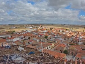
Madrigal de las Altas Torres, Avila, Spain
15.7°C / 60.3°F
20:35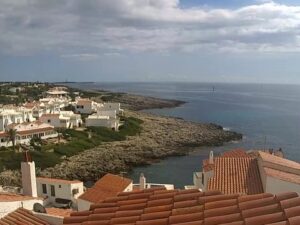
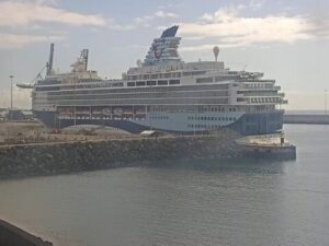
Cruise Pirs Arrecife, Avenida de los Marmoles, Arrecife, Spain
24.1°C / 75.4°F
19:35
Beach Castelldefels, Passeig Marítim, Castelldefels, Spain
21°C / 69.8°F
20:35
Lanzarote Airport, San Bartolome, Lanzarote, Spain
24°C / 75.2°F
19:35
Urdaibai Bird Center, Orueta Auzoa, Spain
 15.3°C / 59.5°F
20:35

The Playa del Albir Webcam looks out from Camping Cap-Blanch at the northern end of Albir’s beach, on the Costa Blanca between Benidorm and Altea. The camera faces roughly south-southeast along a pebble beach dotted with parasols and sunbeds, toward the steep, scrubby ridge of the Serra Gelada, which runs down to the sea on the left of the frame. In the foreground, a beach road with two zebra crossings passes below the camera, and palms and lamp posts line the seafront promenade. The flags of Spain and the Valencian Community fly from two poles beside the road. Small boats can sit at anchor out in the bay, and around midday the sun stands almost straight ahead of the lens, so the water often glitters with glare.
Playa del Albir belongs to L’Alfas del Pi, a municipality of 21,080 people (2025) in the province of Alicante. The beach is about 500 meters (1,640 feet) long and roughly 100 meters (330 feet) deep, and it is made of rounded pebbles rather than sand. It runs from Playa de Cap Blanc in the north, near the camera, to the foot of the Serra Gelada in the south, and it carries a Blue Flag for its water quality and services.
The mountain behind the beach is the Serra Gelada (Sierra Helada in Spanish), protected as a natural park since 29 July 2005. The park covers 5,655 hectares (about 13,970 acres) of land and sea shared by Benidorm, L’Alfas del Pi and Altea, and its seaward face drops in cliffs more than 300 meters (980 feet) high. Its highest point, the Alto del Gobernador, reaches 430 meters (1,411 feet). The park also takes in the Isla de Benidorm and the islets of La Mitjana and La Olla.
Albir began as a planned seaside development and has grown into a village of about 5,000 residents. L’Alfas del Pi has more foreign residents than Spanish ones, and in 2005 it held the second-largest community of Norwegians living abroad, with two public Norwegian schools paid for by the Norwegian government. Since 1991 the seafront promenade has carried the Paseo de las Estrellas, a walk of stars for Spanish film figures honored by the town’s film festival, among them Paco Rabal and Pedro Almodovar.
Albir has a mild Mediterranean climate with little rain, about 423 mm (16.7 inches) a year. Averages for 2015 to 2024 put winter highs at 16 to 17°C (61 to 63°F), with nights around 9 to 10°C (48 to 50°F). Spring warms quickly, from about 18°C (64°F) in March to 23°C (73°F) in May. July and August peak at around 30°C (86°F), and the nights stay warm, at 23 to 24°C (73 to 75°F).
Autumn is still warm, with September averaging 27°C (81°F) by day and October 24°C (75°F), but these are among the wettest months, each bringing about 50 mm (2 inches) of rain against roughly 4 mm (0.2 inches) in July. On the camera, summer means rows of parasols and sunbeds along the waterline. Winter afternoons tend to show a quieter beach, walkers on the promenade and long shadows from the palms across the road.
The walk to the Faro de l’Albir is the classic outing from the beach. A road paved in 1963 leads about 2.5 kilometers (1.6 miles) out to the lighthouse at the tip of the Serra Gelada. The light opened on 30 April 1863 and now serves as an interpretation center, with a room for art exhibitions. The route has been part of Spain’s Sendero Azul (Blue Trail) network since 2013, an award for paths near Blue Flag beaches.
Back on the seafront, the stars of the Paseo de las Estrellas are set into the promenade, and the L’Alfas del Pi film festival, one of the oldest in Spain, holds its screenings each summer, around July. North of the camera, the shore continues as Playa de Cap Blanc toward Altea. Benidorm lies on the far side of the Serra Gelada to the south, and the Isla de Benidorm sits offshore within the same natural park.
Three more cameras on this stretch of the Costa Blanca:
Playa del Albir is in L’Alfas del Pi, in the province of Alicante on Spain’s Costa Blanca, part of the Valencian Community. Benidorm lies to the south, behind the Serra Gelada, and Altea to the north.
The camera looks roughly south-southeast along the pebble beach to the Serra Gelada, whose ridge drops into the sea on the left. A beach road, the palm-lined promenade, two flagpoles, apartment blocks on the right and the bay fill the rest of the frame. Altea is behind the camera and out of view.
Yes. The stream comes from Camping Cap-Blanch’s YouTube channel, and the campsite’s own sign stands on the right of the picture. The same channel also streams a camera on Altea’s beach, one at the campsite entrance and one inside the campsite.
Pebbles. The beach is about 500 meters (1,640 feet) of rounded stones, so water shoes make getting in and out of the sea easier.
No. Benidorm sits on the far side of the Serra Gelada (Sierra Helada), so the mountain that fills the background hides it. The view stops at the ridge and the open sea to its left.
Mild in winter and hot in summer. Highs average 16 to 17°C (61 to 63°F) from December to February and around 30°C (86°F) in July and August. About 423 mm (16.7 inches) of rain falls in a year, very little of it in summer.
Still warm. October averages about 24°C (75°F) by day and 17°C (63°F) at night, but it is one of the wetter months, with around 50 mm (2 inches) of rain.
Yes, the stream runs around the clock, and the current broadcast has been on air since March 2021. After dark the sea and the Serra Gelada fade to black, so the street lamps along the road and promenade light most of what you see until morning.
Source: Camping Cap-Blanch
The best new live webcams and site features, once a week.
By subscribing you agree to receive our weekly email. Unsubscribe any time.