
Live

 18:31:56
 18.5°C / 65.3°F
 Broken Clouds
 58%
58% 5 km/h / 3 mph
 07:14
07:14 18:39
18:39Loading forecast…

Fallingwater, Mill Run Road, Mill Run, Pennsylvania, USA
17.4°C / 63.3°F
18:31
Brice Prairie, Lake Onalaska, Wisconsin, USA
 18.4°C / 65.1°F
17:31
18.4°C / 65.1°F
17:31
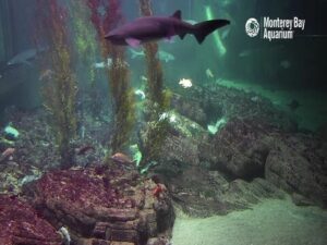
Monterey Bay Aquarium, Cannery Row, Monterey, CA, USA
18.4°C / 65.1°F
15:31
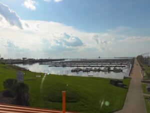

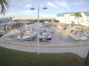


Oregon State University, Corvallis, Oregon, USA
16.1°C / 61°F
15:31The Lock Haven Webcam looks along the levee path on the south bank of the West Branch Susquehanna River in Lock Haven, Pennsylvania, upstream toward the Route 150 bridge that links the city with Dunnstown. A metal railing runs beside the paved path, concrete steps drop toward the water on the right, and the river fills the middle of the wide-angle frame, with grassy banks, trees and houses climbing the slope on the far side. On still days the water lies almost flat and mirrors the trees and the bridge piers. The camera is run by River Valley Internet, an internet provider based in Williamsport that serves Lock Haven and much of north-central Pennsylvania.
Lock Haven sits 171 meters (561 feet) above sea level in Clinton County, on the south bank of the West Branch. Jeremiah Church laid out the town in 1833, it became a borough in 1840 and a city in 1870, and the 2020 census counted 8,108 residents. Across the water, Dunnstown in Woodward Township had 1,464 people in 2020. Route 150, known in town as Woodward Avenue, crosses the river from the southwest corner of Dunnstown into Lock Haven, and that crossing is the bridge in front of the camera.
The path in the foreground is part of the city’s flood defenses, and the reason for them is written in the river’s record. The biggest flood came on March 18, 1936, when the river crested at 9.8 meters (32.3 feet). Hurricane Agnes pushed it to 9.5 meters (31.3 feet) on June 23, 1972, badly damaging the paper mill and the Piper Aircraft plant. Federal, state and local governments began building barriers in 1992, and the project, about 11,000 meters (36,000 feet) of levee plus 300 meters (1,000 feet) of flood wall, was finished in 1995. The top of the levee now carries the Riverwalk, a trail of more than 3.5 kilometers (2.2 miles) between the university at the west end and Memorial Park at the east end.
Upstream of this bridge, the river is held back by the Lock Haven Dam, also called the Dunnstown Dam, which was built in the 19th century to supply water to the West Branch Canal. Canal boats once crossed the pool behind it by cable ferry between two locks near the Jay Street Bridge, a 1986 steel girder span of about 250 meters (822 feet) that carries Route 664 over to Lockport. On clear days a pale line of water spilling over the dam can show between the piers in the middle of the frame.
Winters are cold in this part of the Susquehanna valley. Over the ten years from 2016 to 2025, January highs averaged about 37 F (3 C) and lows about 22 F (-5 C), and the long-term record for Lock Haven shows around 91 centimeters (36 inches) of snow a year. Spring warms quickly, with April highs near 61 F (16 C) and May near 70 F (21 C), and April and May are among the wettest months, each averaging more than 100 millimeters (4 inches) of rain.
Summer brings July highs around 86 F (30 C) and lows near 65 F (18 C), when the trees on the far bank are in full leaf. September stays mild at about 76 F (25 C), and October highs drop to around 65 F (18 C) as the wooded slopes across the river can start to change color. The camera faces roughly west, upstream, so late-afternoon sun can shine toward the lens and the evening sky sits beyond the bridge.
The Riverwalk is the obvious start. Walk west on the levee to the J. Doyle Corman Amphitheater and Floating Stage, where the city holds a summer concert series, or east to Memorial Park, a quiet spot to sit by the water. The river itself is used for swimming, fishing and boating. A short drive away, the Piper Aviation Museum fills the former Piper Aircraft engineering building at William T. Piper Memorial Airport. William T. Piper Sr. built the factory here in 1937, and production stayed until 1984, when it moved to Vero Beach, Florida. The collection includes several Piper J-3 Cubs, the PA-12 Super Cruiser “City of Angels” that flew around the world, and the only PA-47 PiperJet, added in 2025.
Farther out, Hyner View State Park sits 4.8 kilometers (3 miles) north of Hyner on Route 120, the Bucktail Trail. Its overlook stands at 590 meters (1,940 feet), about 396 meters (1,300 feet) above the West Branch, and hang glider pilots launch from a ramp just below the wall. Bald Eagle State Park lies off Route 150 in the Bald Eagle Valley between Lock Haven and Milesburg. The 2,388-hectare (5,900-acre) park surrounds the 700-hectare (1,730-acre) Foster Joseph Sayers Reservoir, with a swimming beach, boating with no horsepower limit, a campground and bald eagles nesting near the dam.
More Pennsylvania and river views to try next:
It stands on the levee path on the south bank of the West Branch Susquehanna River in Lock Haven, Clinton County, in north-central Pennsylvania. It sits downstream of the Route 150 bridge to Dunnstown and looks upstream, roughly west, toward it.
A paved stretch of the levee path with a metal railing and a low concrete wall, concrete steps leading down toward the river, the stone-lined bank, the river itself, the Route 150 bridge ahead, and trees and houses on the Dunnstown side.
The bridge in frame carries Route 150 (Woodward Avenue) between Lock Haven and Dunnstown. The Jay Street Bridge, which carries Route 664 to Lockport, is farther upstream, past the dam.
January highs average about 37 F (3 C) and July highs about 86 F (30 C). The long-term record shows around 91 centimeters (36 inches) of snow a year, and rain is spread through every season.
The river has flooded the city many times, with the two highest crests on record at 9.8 meters (32.3 feet) in 1936 and 9.5 meters (31.3 feet) during Hurricane Agnes in 1972. The levee and flood wall were built between 1992 and 1995.
Yes. The Riverwalk runs along the top of the levee for more than 3.5 kilometers (2.2 miles), from the university to Memorial Park, with benches along the way and lighting for evening walks.
River Valley Internet, a Williamsport-based company that provides wireless and fiber internet across north-central Pennsylvania, streams the camera on its YouTube channel.
Source: River Valley Internet
The best new live webcams and site features, once a week.
By subscribing you agree to receive our weekly email. Unsubscribe any time.
 9.7°C / 49.5°F
 26.6°C / 79.9°F
 20.4°C / 68.7°F