
Live

 19:27:04
 8.7°C / 47.7°F
 Light Rain
 77%
77% 36 km/h / 22 mph
 07:43
07:43 18:41
18:41Loading forecast…
St. John's, Avalon Peninsula, Newfoundland, Canada
 7.9°C / 46.2°F
19:27
7.9°C / 46.2°F
19:27





Cranbrook, East Kootenay, British Columbia, Canada
 14.8°C / 58.6°F
15:57
14.8°C / 58.6°F
15:57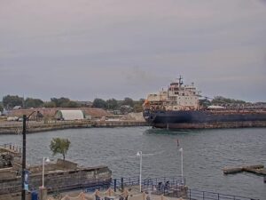






The Port aux Basques Webcam looks down on the Marine Atlantic ferry terminal in Channel-Port aux Basques, on the southwest tip of Newfoundland. From a window above the waterfront, the camera takes in the yard where transport trailers wait in rows, the boarding ramps, the harbor, a low breakwater and the white tower of Channel Head Lighthouse at the harbor mouth. This is the province’s main western port of entry, so the scene rarely sits still: trucks line up for the next sailing, ferries berth and pull away, and storms roll in from the Gulf. A panel down the right side of the stream shows the temperature, wind speed, wind direction and gusts.
Channel-Port aux Basques is a town of 3,547 people (2021 census), down from 6,102 in 1981. Marine Atlantic ferries sail from here to North Sydney on Cape Breton Island, Nova Scotia, a crossing of 96 nautical miles (178 kilometers, or about 110 miles) that runs year-round. The ferry links the Trans-Canada Highway across the strait. The current fleet includes Blue Puttees and Highlanders, both in service since 2011 and 199.5 meters (655 feet) long, Leif Ericson from 2001, and the newest ship, Ala’suinu, which joined in 2024 at 202.9 meters (666 feet).
The name goes back to Basque whalers from Spain, who used the harbor as a sheltered anchorage and watering place in the early 16th century. Channel, the neighboring settlement, was founded by fishermen from the Channel Islands in the early 1700s. Today the town takes in the old villages of Port aux Basques, Channel, Grand Bay and Mouse Island, and it was incorporated in 1945. The railway reached the harbor in 1897, the first passenger train arrived on June 30, 1898, and the ferry link to North Sydney followed soon after.
The Port aux Basques Webcam is mounted on a house built in 1897 as the town’s Customs House, later home to the Pike, Anderson and Tilley families and now being restored. Locals have long called this view the Tilley Cam, after Mr. Tilley, remembered as “The Catalogue Man”, who watched ferries and storms from his rocking chair through binoculars and logged wind speeds and weather in his journals. The white tower at the right of the frame is Channel Head Lighthouse, established in 1875 and rebuilt in 1895, about 2 kilometers (1.2 miles) southeast of the town center. In September 2022 the wind and storm surge of Hurricane Fiona washed away more than 100 homes in Newfoundland, most of them in this town.
The town has a subarctic climate shaped by the cold water around it. January averages a high of -1.8 C (29 F) and a low of -8.4 C (17 F), and about 355 centimeters (140 inches) of snow falls in a typical year, so the rooftops and the yard in the foreground can turn white. Ice and high seas in the Cabot Strait can hold the ferries in port in winter. Spring arrives slowly: April highs reach only 4.3 C (40 F), with lows around -1.5 C (29 F).
Summer is mild rather than warm. July averages a high of 17.2 C (63 F) and a low of 10.7 C (51 F), and October still manages 10.6 C (51 F) by day and 4.1 C (39 F) at night. Annual precipitation totals 1,594.5 millimeters (62.8 inches), so wet, grey days are frequent. Wind is the local signature. About 25 kilometers (16 miles) northwest of town on the Trans-Canada Highway, the Wreckhouse stretch is known for gusts strong enough to topple vehicles, while the camera’s panel tracks the gusts down at the harbor.
In town, the Railway Heritage Centre tells the story of the railway, the fishery and the ferry service. Its line of rolling stock includes a snowplow, a diesel locomotive, two World War II tank cars, a sleeper car and a caboose, and the museum also displays two astrolabes recovered from shipwrecks off Isle aux Morts. The Gulf Museum on Main Street covers local history, and the Grand Bay Trail and the beach boardwalk make for an easy walk along the shore.
J.T. Cheeseman Provincial Park lies about 10 kilometers (6 miles) from the ferry terminal, with Cape Ray Beach, the Smokey Cape Walking Trail and a short path to a waterfall. The beach is a nesting ground for endangered piping plovers, so visitors are asked to walk on the wet sand below the high water mark and keep dogs leashed. Route 408 continues to Cape Ray, where a light has stood since 1871; the present white concrete tower dates from 1960, and the old keeper’s house is now a museum and gift shop. The Hook and Line Museum in nearby Burnt Islands documents the inshore fishery with live demonstrations.
More Canadian harbors and ferry terminals to watch next:
Channel-Port aux Basques is on the southwest coast of Newfoundland, in the province of Newfoundland and Labrador, Canada. It sits on the Cabot Strait, and North Sydney in Nova Scotia lies 96 nautical miles (178 kilometers) away by ferry.
The camera looks over the Marine Atlantic terminal yard, its boarding ramps and the harbor, out past a breakwater and low rocky islands to Channel Head Lighthouse. Trucks and trailers move through the yard in the foreground, and the ferries tie up at the berths in the center and left of the frame. A panel on the right shows the temperature, wind speed, wind direction and gusts.
Marine Atlantic says the crossing usually takes between 5 and 7 hours, depending on the ship and the conditions. The route runs year-round, seven days a week.
The name honors Mr. Tilley, known locally as “The Catalogue Man”, whose family lived in the house where the camera is mounted. He spent hours watching the harbor through binoculars and kept journals of wind speeds, weather and daily life on the waterfront.
Cool and windy for most of the year. July highs average 17.2 C (63 F), January highs -1.8 C (29 F), and about 355 centimeters (140 inches) of snow falls each winter. Rough seas and storms in the Cabot Strait can delay or cancel ferry sailings.
Wreckhouse is a stretch of the Trans-Canada Highway about 25 kilometers (16 miles) northwest of town where the wind can blow hard enough to topple vehicles.
Yes. The operator runs it around the clock, though storms, power outages and internet drops on this exposed coast occasionally interrupt the stream.
Source: PAB Live
The best new live webcams and site features, once a week.
By subscribing you agree to receive our weekly email. Unsubscribe any time.
 12.8°C / 55°F
 12.8°C / 55°F