Live

 18:26:20
 16.9°C / 62.4°F
 Few Clouds
 64%
64% 12 km/h / 7 mph
 07:23
07:23 18:45
18:45Loading forecast…
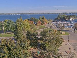
The Port Colborne Webcam looks out from Canalside Restaurant & Inn on West Street to Bridge 21, the Clarence Street lift bridge at the Lake Erie end of the Welland Canal in Ontario, Canada. Two steel lattice towers stand over the canal, and when a ship is due, the road deck rises between them so the vessel can slide through below. Between passages the span sits down and carries traffic along Clarence Street, with grass and trees lining the near bank. The ships are the draw. Great Lakes freighters, ocean-going salties and cruise ships all use this channel on the way between Lake Erie and Lake Ontario, and the camera can pan and zoom to follow a hull as it moves past. After dark, the bridge lights and a lantern in the foreground take over the frame.
Port Colborne sits on the north shore of Lake Erie in the Niagara Region, at the southern entrance to the Welland Canal. The canal runs 43 kilometers (27 miles) to Lake Ontario and lifts or lowers ships 99.5 meters (326 feet) through eight locks. The town was first known as Gravelly Bay and took its present name from Sir John Colborne, Lieutenant Governor of Upper Canada when the first canal’s southern terminus opened here in 1833. Today’s channel is the fourth version of the canal, officially opened on August 6, 1932. The city counted 20,033 residents in the 2021 census.
The bridge in the frame is a vertical lift bridge: instead of tilting, the whole road deck travels straight up between the towers. It dates from 1929 and is one of three lift bridges still operating on the canal. Two other Port Colborne crossings, Bridge 19 at Main Street and Bridge 19A at Mellanby Avenue, are bascule bridges. About 1.5 kilometers (0.9 miles) up the canal is Lock 8, the guard lock that adjusts for the changing water level of Lake Erie. At roughly 420 meters (1,380 feet), it is often listed among the longest canal locks in the world.
Around 3,000 ships carrying about 40 million tonnes of cargo use the canal in a typical year, and its locks take vessels up to 225.5 meters (740 feet) long and 23.8 meters (78 feet) wide. Lakers built for the Great Lakes share the channel with salties, the ocean-going ships that arrive through the St. Lawrence Seaway, and the inn hosting the camera counts more than 70 cruise ships and over 100 salties among the vessels passing its rooms.
Summers on this stretch of Lake Erie are warm rather than hot. July averages highs of 25.9 C (79 F) and lows of 17.8 C (64 F), and the record high is 35 C (95 F). Spring arrives slowly, with April highs of 11.5 C (53 F) and lows of 2.4 C (36 F). The canal is open to shipping from late March through December, so for most of the year the lift span on the Port Colborne Webcam rises and falls as ships come through.
October is mild, averaging highs of 14.8 C (59 F) and lows of 7.3 C (45 F), and November is the wettest month at 101 millimeters (4 inches). Winter is cold and snowy. January averages a high of -0.4 C (31 F) and a low of -6.9 C (20 F) and brings 40.5 centimeters (16 inches) of the city’s 137.7 centimeters (54 inches) of yearly snow, and the record low is -26 C (-15 F). The canal closes for the winter because of the weather, so from late December to late March the camera shows a quiet channel, with the bridge left down for road traffic and, after a snowfall, white banks.
The camera’s host is an attraction in its own right. Canalside Restaurant & Inn at 232 West Street serves lunch and dinner with local craft beers and Ontario wines, has a patio overlooking the canal and two suites upstairs, and its seating looks straight at the lift bridge. Historic West Street runs along the canal with shops and restaurants. Lock 8 Gateway Park on Mellanby Avenue has a raised viewing platform over the lock, flower gardens and fountains. It was established in 1979 to mark the 150th anniversary of the first Welland Canal.
The Port Colborne Historical and Marine Museum and Heritage Village tells the canal’s story among heritage buildings, gardens and a tea room. On Lake Erie, H.H. Knoll Lakeview Park overlooks Sugarloaf Marina and Gravelly Bay, and Nickel Beach has shady picnic areas and unsupervised swimming. The Friendship Trail is a popular choice for cycling and walking. Every Civic Holiday weekend in early August, the Canal Days Marine Heritage Festival fills the waterfront with free concerts, the tall ship Empire Sandy, a boat parade of lights, fireworks and lighthouse tours, with vendors along West Street and the main stage at H.H. Knoll Lakeview Park.
More cams for ship watchers and visitors to the Niagara area:
Port Colborne is in the Niagara Region of Ontario, Canada, on the north shore of Lake Erie at the southern end of the Welland Canal. Welland is about 12 kilometers (7 miles) north, Niagara Falls about 25 kilometers (16 miles) to the northeast in a straight line, and Buffalo, New York, about 30 kilometers (19 miles) east.
The camera faces Bridge 21, the Clarence Street lift bridge, from Canalside Restaurant & Inn on West Street. You can watch the deck rise for passing freighters, salties and cruise ships, then drop again for road traffic. The camera can pan and zoom, so the framing can shift to follow a ship along the canal.
Summers are warm, with July highs around 26 C (79 F). Winters are cold, with January lows around -7 C (20 F) and about 138 centimeters (54 inches) of snow a year.
It is Bridge 21, the vertical lift bridge that carries Clarence Street across the canal. Built in 1929, it is one of three lift bridges still working on the Welland Canal.
The canal closes to shipping in winter, from late December until late March, so the bridge stays down and the channel stays empty for those months. During the season ships arrive at intervals, so a quiet spell between passages is normal.
Lock 8 is about 420 meters (1,380 feet) long, which puts it among the longest canal locks in the world. Lock 8 Gateway Park has a raised platform for watching ships pass through.
The Canal Days Marine Heritage Festival runs over the Civic Holiday long weekend in early August. In 2026 it ran from July 31 to August 3.
Source: StreamTime LIVE
The best new live webcams and site features, once a week.
By subscribing you agree to receive our weekly email. Unsubscribe any time.
 13.2°C / 55.8°F

 19°C / 66.2°F

 7.9°C / 46.2°F



 17.6°C / 63.7°F