Live

 20:43:12
 7.6°C / 45.7°F
 Broken Clouds
 74%
74% 12 km/h / 7 mph
 08:29
08:29 17:53
17:53Loading forecast…
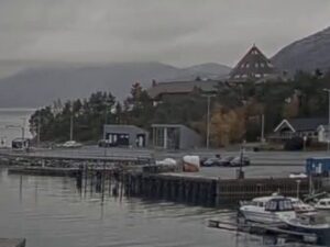
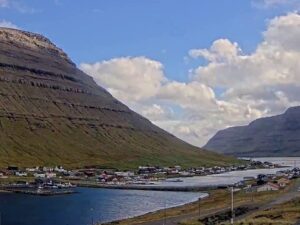
The Skopun Webcam looks down from the slope above Skopun, a harbor village on the north coast of Sandoy in the Faroe Islands. Rooftops fill the bottom of the frame, and just beyond them the harbor sits behind its breakwaters, with the quay and whatever boats are in port that day. Past the harbor mouth the view opens onto Skopunarfjordur, the strait that separates Sandoy from the islands to the north, whose long, low outline closes the horizon. More than half of the picture is sky, which suits a place where the weather turns by the hour. Cloud banks roll in from the Atlantic, showers cross the fjord as gray curtains, and on clear days the far shore stands out sharp against the water.
Skopun is young by Faroese standards. The village was founded in 1833 and is now the second-largest settlement on Sandoy, with 481 residents counted in September 2025. Its harbor, the one in the foreground of the Skopun Webcam, was built in 1926 and extended later, and a harbor gate was added in 1982. The village church dates from 1897 and was put up using timber from the old church at Vestmanna.
The first road in the Faroe Islands was built here in 1917, linking Skopun with Sandur on the south side of the island. For most of the century that followed, this harbor was Sandoy’s front door. The car ferry Teistin sailed between Skopun and Gamlaraett on Streymoy, occasionally calling at the small island of Hestur on the way. That service ended in December 2023, when the Sandoyartunnilin opened on 21 December. The tunnel runs 10.8 kilometers (6.7 miles) under Skopunarfjordur, reaches 155.1 meters (509 feet) below sea level at its deepest point, and surfaces at Tradardalur in the middle of Sandoy. Traffic to the island no longer passes through the village, so the harbor on screen is a quieter place than it was when every car bound for Sandoy rolled off the ferry here.
Skopun’s best-known landmark stands on the cliffs outside the village: a blue postbox 7.42 meters (24.3 feet) high and 4.45 meters (14.6 feet) wide. It was once the largest in the world and earned the village a Guinness World Records entry. It no longer holds the record, but it still serves as a mark that sailors can pick out from the sea.
Skopun has a subpolar oceanic climate, kept mild by the Atlantic on every side. The nearest long-running weather record is from Torshavn, across the fjord on Streymoy. Winters there are exceptionally mild for the latitude: January highs average 6.2 C (43 F) and lows 2.1 C (36 F), and the coldest temperature on record is -11.0 C (12.2 F). Summers stay cool. July highs average 12.9 C (55 F) and August 13.3 C (56 F), with nights near 9 C (48 F), and the record high is only 22.0 C (71.6 F).
Rain is the constant. Torshavn records about 1,399 millimeters (55 inches) a year spread over 192 rain days, with January the wettest month, and just over 1,000 hours of sunshine annually, so a gray frame is the normal one. In autumn and winter, Atlantic lows can push swell against the breakwaters and hide the far shore behind rain. Spring and summer are typically gentler, and the long days give the best chance of a clear view to the far shore. At almost 62 degrees north the light swings hard between seasons: midsummer nights never turn fully dark, while in December the Skopun Webcam spends most of the day looking at harbor lights.
The giant postbox is the obvious first stop, at Tormansvegur 58 above the village. From Skopun a line of cairns leads walkers into the quiet valley of Slavansdalur. A longer outing heads for Hovdahagi, the outfield at the far northwestern point of Sandoy, where the islet of Trollhovdi, the troll’s head, lies just offshore. Soltuvik bay has a wide sandy beach with bird cliffs close by, and guided night tours visit the storm petrel colony at Borgin.
Sandur, at the other end of the 1917 road, has the Sandur Art Museum and the Nordara Koyta village museum, and the ferry to the island of Skuvoy leaves from its harbor. The smaller villages of Husavik, Skalavik, Dalur and Skarvanes lie further along the island’s roads. Getting to Sandoy is simple now. The tunnel from Gamlaraett has cut the drive from Torshavn to the island from about 60 minutes to 16, a toll is charged for the crossing, and bus route 650 runs between Torshavn and Sandur.
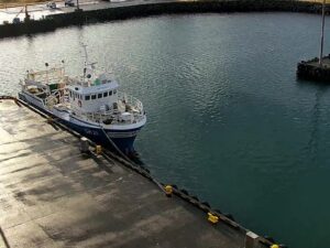
These cameras show more of Sandoy and the capital across the fjord.
Skopun is on the north coast of Sandoy, one of the southern Faroe Islands, a self-governing island group in the North Atlantic within the Kingdom of Denmark. It faces Streymoy, the island of the capital Torshavn, across the strait of Skopunarfjordur.
The camera sits above the village and looks over its rooftops to the harbor, with the breakwaters, the quay and any boats in port. Beyond them are the open water of Skopunarfjordur, the islands on the far side and a wide stretch of sky.
Cool, wet and windy, but rarely very cold. Nearby Torshavn averages highs of about 6 C (43 F) in January and 13 C (56 F) in August, with rain on 192 days of the year.
By road through the Sandoyartunnilin, the 10.8 kilometer (6.7 mile) undersea tunnel from Gamlaraett on Streymoy to central Sandoy. The drive from Torshavn to Sandoy takes about 16 minutes, and bus route 650 links Torshavn with Sandur.
No. The ferry Teistin ran between Gamlaraett and Skopun until December 2023, when the tunnel opened and the service stopped.
It is a blue postbox 7.42 meters (24.3 feet) tall on the cliffs outside the village. It was once the largest in the world, and it remains one of the largest.
Skopun had 481 residents in September 2025, which makes it the second-largest settlement on Sandoy.
Source: Faroe Islands Live
The best new live webcams and site features, once a week.
By subscribing you agree to receive our weekly email. Unsubscribe any time.


 6.4°C / 43.5°F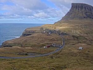
 5.4°C / 41.7°F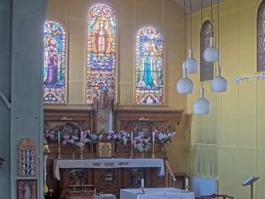
 9.9°C / 49.8°F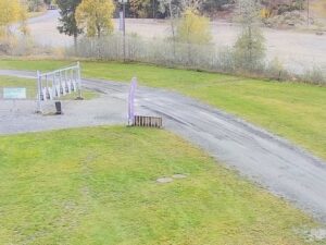

 8.3°C / 46.9°F