Live

 19:53:37
 8.6°C / 47.5°F
 Scattered Clouds
 76%
76% 32 km/h / 20 mph
 08:16
08:16 18:14
18:14Loading forecast…
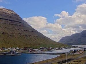
The Gasadalur Webcam looks across the western tip of Vagar in the Faroe Islands, from the hillside above the only road into the village of Gasadalur. The houses sit on a grassy shelf on top of the sea cliffs, with a steep, layered basalt mountain rising behind them on the right of the frame and the open North Atlantic filling the left. On the horizon sits the island of Mykines, about 11 kilometers (6.8 miles) to the west. The road curves through the foreground past a red-roofed barn and a lone white house, so the odd car heading down to the village is easy to follow. The light here shifts by the hour: a sunrise can turn Mykines pink, and a clear midday can give way to a low band of cloud within half an hour.
Gasadalur is one of the smallest villages in the Faroe Islands, with 16 residents recorded in April 2025. It lies at the far western end of Vagar, the third largest island in the archipelago at 176 square kilometers (68 square miles). For most of its history the village had no road at all. Residents had to cross mountains more than 400 meters (1,300 feet) high to reach their neighbors, and the postman carried the mail over the mountain from Bour three times a week.
That changed in 2004, when the Gasadalstunnilin tunnel was blasted through the rock. It runs 1.4 kilometers (0.9 miles), and the road that leaves it is the one sweeping through the bottom of this camera’s frame toward the houses. Before the tunnel, Gasadalur was the only village in the Faroes without a road connection.
The village is best known for Mulafossur, a waterfall that drops 30 meters (98 feet) off the cliffs straight into the Atlantic, about 200 meters (660 feet) south of the houses. The falls are out of this camera’s line of sight, since the water pours down the seaward face of the cliffs below the village. The ridges that wall in the valley are among the highest on the island. Arnafjall, at 722 meters (2,369 feet) the highest peak on Vagar, rises about 2.4 kilometers (1.5 miles) north of the village, and Eysturtindur reaches 715 meters (2,346 feet) to the east-northeast.
Gasadalur shares the mild, wet climate of the whole Faroe chain, kept from extremes by the surrounding ocean. Winter days typically reach about 5 C (41 F), with nights around 1 C (34 F). Summer stays cool, with July and August highs averaging about 12 C (54 F) and nights near 9 C (48 F). Rain is the constant. Around 1,650 millimeters (65 inches) falls in a typical year, spread over roughly 230 days with at least a millimeter, and October through January is the wettest stretch. April and May are the driest months, each with well under half the rain of October.
Daylight swings hard at 62 degrees north. Around the June solstice the sun is up for about 19 hours and only dips about 4 degrees below the horizon at midnight, so the sky never gets fully dark and the camera keeps a usable picture almost around the clock. In late December daylight shrinks to about five hours. Even in mid-October the sun peaks at under 20 degrees above the horizon, so autumn frames carry long shadows across the fields. After dark the picture turns black apart from the streetlights along the village road.
The first stop for most visitors is the waterfall itself. A marked viewpoint about 400 meters (1,300 feet) south of the village looks back north to Mulafossur where it leaves the cliff. For a longer outing, the old postman’s path between Bour and Gasadalur still climbs over the mountain. The route covers about 3.5 kilometers (2.2 miles), tops out at the A Skardi pass at 434 meters (1,424 feet) and takes around two and a half hours, which gives a fair sense of what the village’s mail carrier faced before the tunnel opened.
Farther east on Vagar are the lake Sorvagsvatn, which covers 3.4 square kilometers (1.3 square miles), the smaller Fjallavatn and the Bosdalafossur waterfall. Off the coast stand the islet of Tindholmur and the sea stacks of Drangarnir. Vagar Airport, the only airport in the Faroe Islands, sits near Sorvagur. It began as a base built by British Army engineers during World War II and reopened for civilian flights in 1963. Since the Vagatunnilin subsea tunnel opened in 2002, the drive from the airport to Torshavn, 46 kilometers (29 miles) away, runs entirely by road.
For more of the Faroes and the cliff coasts of the North Atlantic, these cameras are a good next stop.
Gasadalur is at the western end of Vagar in the Faroe Islands, a self-governing part of the Kingdom of Denmark in the North Atlantic. The only road in runs through a 1.4 kilometer (0.9 mile) tunnel, and Vagar Airport near Sorvagur is the closest airport.
The camera looks down the access road to the houses of Gasadalur on their clifftop shelf, with a steep mountain on the right, the open Atlantic on the left and the island of Mykines on the horizon. Open fields, a red-roofed barn and a white house fill the foreground.
No. Mulafossur drops 30 meters (98 feet) down the seaward face of the cliffs just south of the village, out of this camera’s line of sight. A marked viewpoint a short walk from the houses gives the classic view of the falls.
Cool and wet for most of the year. Winter highs sit around 5 C (41 F) and summer highs around 12 C (54 F), and rain falls on roughly 230 days a year, most heavily from October to January.
Gasadalur had 16 residents in April 2025. The figure has moved between 11 and 23 since 2010, when it peaked at 23, and it stood at 11 in 2020.
In 2004, when the Gasadalstunnilin tunnel opened. Before then it was the only village in the Faroes with no road link, and the postman crossed the mountain on foot three times a week.
The camera streams around the clock, but the view needs daylight. In June and July that means almost any hour, while in December the usable window shrinks to a few hours around midday local time. At night only the streetlights along the village road show.
Source: Faroe Islands Live
The best new live webcams and site features, once a week.
By subscribing you agree to receive our weekly email. Unsubscribe any time.

 7.8°C / 46°F
 10.1°C / 50.2°F


 9.7°C / 49.5°F

 15.1°C / 59.2°F