Live

 23:57:16
 5.1°C / 41.2°F
 Light Rain
 91%
91% 42 km/h / 26 mph
 07:40
07:40 16:43
16:43Loading forecast…
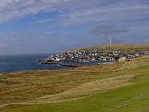
The Gjogv Webcam looks down on Gjogv, the northernmost village on the island of Eysturoy in the Faroe Islands, from a grassy slope above the rooftops. A red roof and a green one fill the foreground, the village’s white, black and red houses spread out below, and a stream runs past a lane in the lower right of the frame. Beyond the last houses the sea opens out, and across the water rises the mountain wall of Kalsoy, whose sheer west side faces the village. The scene rarely holds still for long. Showers cross the sound in minutes, cloud drags over the far summits, and on a clear afternoon the sun lights up the cliffs on the opposite shore. After a passing shower, raindrops can sit on the lens for a while.
Gjogv takes its name from the gorge at the north end of the village, a sea-filled cleft about 200 meters (650 feet) long that runs out to the open sea. It has served as the village harbour for centuries and was probably already in use in the Viking Age. Small boats are lifted out of the water rather than left afloat, and new steps and a new house for the boat hoist were built during the Second World War. The village first appears in written records in 1584.
Life here was built on fishing and on drying and salting the catch. The population peaked at 286 around 1945 and has fallen to 19 residents in 2025, yet around 35,000 visitors a year come to see the gorge. The church dates from 1929 and was designed by the vicar Vilhelm Nielsen, while the school built in 1883 is no longer in use. Gjogv belongs to Sunda municipality. Roads arrived late: the one to Eidi opened in 1959 and the one to Funningur in 1964, and the way in still crosses the narrow mountain pass of Gjaarskard.
High ground surrounds the village. Slaettaratindur reaches 882 meters (2,894 feet) and Grafelli 857 meters (2,812 feet) in the uplands toward Eidi, and Middagsfjall at 601 meters (1,972 feet) and Tyril at 535 meters (1,755 feet) also rise above Gjogv. Out on the coast, the sea stack Bugvin stands 188 meters (617 feet) tall.
Gjogv has a cool oceanic climate, and the long-term record from the Danish Meteorological Institute’s station in Torshavn shows how narrow the range is. January averages a daily high of 6 C (43 F) and a low of 2 C (36 F). Spring warms slowly, with April highs still only about 8 C (46 F). July is the warmest month, with highs near 13 C (55 F) and nights around 9 C (48 F), and October days come in at about 10 C (49 F). Precipitation falls on about 192 days a year and adds up to roughly 1,400 mm (55 inches), while Torshavn logs only about 1,000 hours of sunshine annually.
On the Gjogv Webcam the seasons show up mostly as light and colour. Daylight lasts more than 19 hours around late June, so the summer view stays lit well into the evening and the slopes stay green. By early October the long grass in the foreground has already turned straw coloured. Winter days shrink to about five hours, which leaves the frame dark for most of the day. The weather turns quickly in any month, and one afternoon can bring low cloud on Kalsoy, a squall across the water and then bright sun on the cliffs.
Start with the gorge. Stairs lead all the way down to the water, and a tarred path runs out to the end of the cleft, so you can stand between its walls and look out to sea. The 1929 church is a short walk away in the village. Gjaargardur, which opened as a hotel in 1984, runs as a guesthouse, and the Flatnagardur campsite has taken tents and campervans since 2014.
For a longer outing, the hike to the Ambadalur valley takes roughly an hour and ends with a view of Bugvin rising from the sea. Puffins can be seen around Gjogv from early May to late August. Experienced walkers can also cross the uplands from Eidi to Gjogv over Slaettaratindur when the weather allows. The drive from Torshavn takes less than an hour, with the last stretch over the Gjaarskard pass, where the road is narrow but safe to drive.
More villages and towns from the Faroe Islands and the North Atlantic:
Gjogv is the northernmost village on Eysturoy in the Faroe Islands, in Sunda municipality. It sits at the end of a deep valley on the north coast, and the drive from the capital, Torshavn, takes less than an hour.
The camera looks over the village from a hillside, taking in the rooftops, a stream and lane in the foreground, the sea beyond the houses and the steep west side of Kalsoy across the water.
Mild, wet and changeable. Average highs run from about 6 C (43 F) in January to 13 C (55 F) in July, and precipitation falls on roughly 192 days a year.
Gjogv had 19 residents in 2025, down from a peak of 286 around 1945. It still draws around 35,000 visitors a year.
Yes. Stairs run all the way down to the water, and a tarred path leads to the end of the 200 meter (650 foot) gorge that serves as the village harbour.
From early May to late August. The roughly one hour hike to the Ambadalur valley, with its view of the Bugvin sea stack, is a good place to look for seabirds.
By car, in less than an hour. The road climbs over the Gjaarskard mountain pass, which is narrow but safe to drive. Gjogv has had road links to Eidi since 1959 and to Funningur since 1964.
Source: Faroe Islands Live
The best new live webcams and site features, once a week.
By subscribing you agree to receive our weekly email. Unsubscribe any time.



 16.4°C / 61.5°F
 9.1°C / 48.4°F

 4°C / 39.2°F
 6.4°C / 43.5°F