
 English
 简体中文
 Deutsch
 Français
 Español
 Nederlands
 Svenska
 Italiano
 日本語
 Polski
 Português
 Русский
 Ελληνικά
 العربية
 Türkçe
Live
 11:16:21
 10.5°C / 50.9°F
 Few Clouds
 65%
 26 km/h / 16 mph
 07:02
 16:41
Loading forecast…

Holy Dormition Pochayiv Lavra, Pochaiv, Ternopil Oblast, Ukraine
 4.7°C / 40.5°F
13:16


San Pellegrino in Alpe, Garfagnana, Tuscany, Italy
2.9°C / 37.2°F
12:16



Playa del inglés gran canaria, Maspalomas, Spain
23.7°C / 74.7°F
11:16
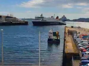
The St Helier Webcam looks down on the A1 where it runs along the Esplanade, the waterfront road of Jersey’s capital, with two cameras on one page. The main view faces west toward the road’s busy junction with Victoria Avenue, past granite walls and a line of trees, with a strip of St Aubin’s Bay along the top of the frame. The second view faces east to the Waterfront underpass on La Route de la Liberation, with office and apartment blocks on one side of the road and a large car park running toward the sea on the other. Islands Insurance runs both and calls them its JamCams, so the traffic is the point: buses, lorries and commuter cars, and whether the lanes are moving or queued. Behind it all, the bay fills and drains with one of the largest tidal ranges in the world.
St Helier sits on the south coast of Jersey at the eastern end of St Aubin’s Bay, and had 35,822 residents at the 2021 census. The A1 begins at Liberation Square and heads west along the southern edge of town as part of the ring road. It passes a grade-separated roundabout at Castle Street, the Gloucester Street junction, the junction with Victoria Avenue and the turn for St Aubin’s Road, then leaves town for First Tower and carries on toward St Aubin and St Brelade. Traffic from the east reaches it through the Fort Regent tunnel, 253 meters (830 feet) long, which opened on 25 February 1970 and links Route du Fort with La Route de la Liberation.
The road in front of the cameras took its present shape after land reclamation in the 1990s. Before that, the Esplanade itself was the dual carriageway. Today the A1 drops into an underpass on La Route de la Liberation with two lanes in each direction and a 48 km/h (30 mph) limit. A separate single-lane underpass, the old exit from the former Esplanade car park, has been reopened to ease congestion on Rue de L’Etau. Its clearance is only 2.2 meters (7.2 feet), and it is open on weekdays from 6am to 6pm.
The operator labels the two views Waterfront West and Waterfront Underpass East. In the west view the sands and water of the bay show above the trees, while the east view takes in the reclaimed Waterfront, with the sea at the far right of the frame.
St Helier has a mild maritime climate. Average highs run from about 9°C (48°F) in January to about 21°C (70°F) in July, and average lows from 5°C (41°F) in January to 14°C (57°F) in July, based on 1991 to 2020 records for the town. The same records put sunshine at about 2,083 hours a year. In winter the morning commute starts close to sunrise, so wet roads often shine with headlights and street lamps in the first frames of the day.
The other big variable is the tide. Jersey has one of the largest tidal ranges in the world, over 12 meters (39 feet) on spring tides, so the strip of St Aubin’s Bay above the trees in the west view can change from open water to wide, wet sand within a few hours. Summer evenings stay light, so the homeward traffic on the Esplanade often runs in full daylight.
Elizabeth Castle stands on a tidal island in St Aubin’s Bay just off the town. Work on its earliest parts began in 1594, and Sir Walter Raleigh, Governor of Jersey from 1600 to 1603, named it after Elizabeth I. At low tide a causeway of about 1.1 kilometers (0.7 miles) crosses the sand on foot. At other times the wading castle ferries Charming Betty and Charming Nancy cross at any tide height, weather permitting, taking about 15 minutes at high tide. A breakwater runs on to the Hermitage Rock and the Hermitage of Saint Helier, and the guns and bunkers the Germans added during the Second World War are now part of the Jersey Heritage museum. Farther west, the causeway to St Aubin’s Fort covers extremely quickly on a rising tide, and the Jersey Coast Guard warns that the crossing can take up to 15 minutes.
In town, Liberation Square was laid out in the 1990s in front of the Pomme d’Or for the 50th anniversary of the island’s Liberation, and it marks the eastern start of the A1. The Central Market on Beresford Street has traded under cover since 1882, and the Jersey Museum and the Maritime Museum are both in St Helier. Fort Regent, built as a barracks after the Napoleonic Wars and developed as a leisure complex from 1967, sits above the tunnel that feeds the road from the east. People’s Park, once called West Park, was one of the town’s two parks by the late 19th century.
More island coastlines and town roads to check:
St Helier is on the south coast of Jersey, the largest of the Channel Islands, at the eastern end of St Aubin’s Bay. The cameras look over the A1 on the Esplanade, at the western edge of the town center.
The main view looks west along the Esplanade toward the Victoria Avenue junction, with trees, granite walls and St Aubin’s Bay beyond the road. The second view looks east to the Waterfront underpass on La Route de la Liberation, with the reclaimed Waterfront and its car park on the seaward side.
Mild for most of the year. Average highs are about 9°C (48°F) in January and 21°C (70°F) in July, with lows of 5°C (41°F) and 14°C (57°F), and the town gets about 2,083 hours of sunshine a year.
Islands Insurance, a local insurance broker with its Jersey office at Kingsgate House on the Esplanade. It publishes both views on its own website as its JamCams.
It is 253 meters (830 feet) long, opened on 25 February 1970, and links Route du Fort with La Route de la Liberation, the road on the east camera.
The reopened single-lane underpass between the former Esplanade car park and La Route de la Liberation is open from 6am to 6pm, Monday to Friday. Its height limit is 2.2 meters (7.2 feet).
Walk the causeway of about 1.1 kilometers (0.7 miles) across the sand at low tide, or take one of the two wading castle ferries when the tide is in.
Jersey has one of the largest tidal ranges in the world, over 12 meters (39 feet) on spring tides. The west camera shows the change as the bay fills and empties.
Source: Islands Insurance
The best new live webcams and site features, once a week.
By subscribing you agree to receive our weekly email. Unsubscribe any time.
 6.6°C / 43.9°F