Live
Kralingseplein, Rotterdam, Netherlands
Kralingseplein, Kralingen, Rotterdam, Netherlands
 10.5°C / 50.9°F
 22:24
22:24
 23:24:59
 14.4°C / 57.9°F
 Overcast Clouds
 91%
91% 4 km/h / 2 mph
 07:38
07:38 18:29
18:29Loading forecast…
Kralingseplein, Kralingen, Rotterdam, Netherlands
10.5°C / 50.9°F
22:24

Kalita Hill, Anykščiai, Anykščiai District Municipality, Lithuania
11.7°C / 53.1°F
23:24

Riverside Rd, Hoveton, Norwich NR12 8UD, United Kingdom
 7.1°C / 44.8°F
21:24
7.1°C / 44.8°F
21:24
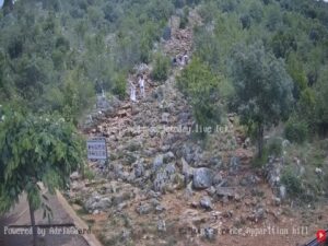
Church of Saint James the Greater (Apostle) - Medjugorje, Međugorje, Bosnia and Herzegovina
 13.2°C / 55.8°F
22:24
13.2°C / 55.8°F
22:24

Monkstown, Cork Harbour, County Cork, Ireland
 11.9°C / 53.4°F
21:24
11.9°C / 53.4°F
21:24

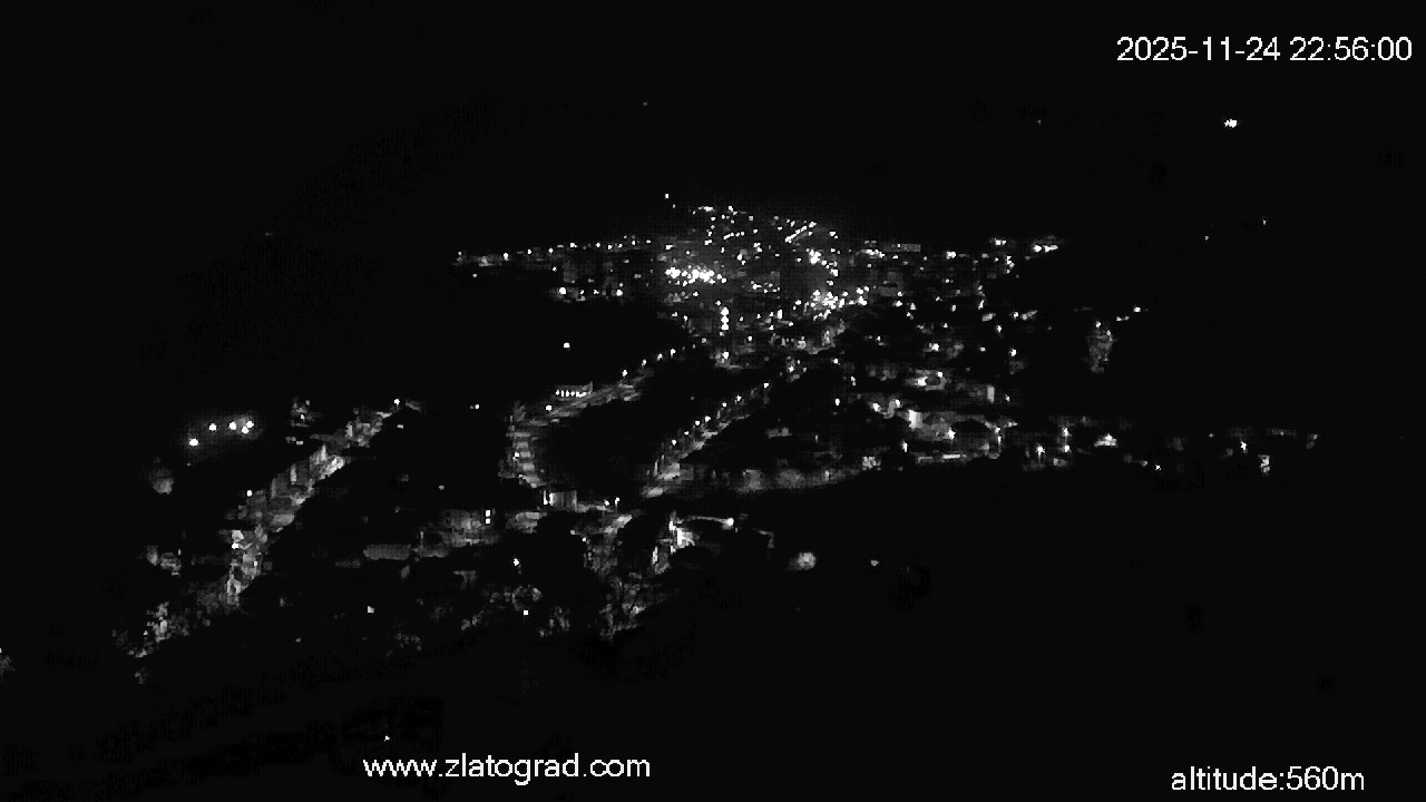
The Zlatograd Webcam looks down on Zlatograd, a small town in the Rhodope Mountains of southern Bulgaria, from a hillside at 560 meters (1,837 feet). Red tile roofs fill the floor of the Varbitsa valley, a cluster of apartment blocks rises near the middle, and a slim white minaret stands out against them, with a sports ground and its running track on the left of the frame. Forested ridges close the view behind the town. A second tab switches to Pechinsko Pass, a grassy clearing on the ridge between Zlatograd and Madan, where a dirt track runs past conifers and ridge after ridge of the Rhodopes fades into the distance. Both cameras publish still images rather than video, and the player reloads them every 10 seconds, so cloud, haze and shadow shift across the scene through the day.
Zlatograd lies at 521 meters (1,709 feet) in a valley between Rhodope massifs, in Smolyan Province, about 60 kilometers (37 miles) from the provincial capital, Smolyan. Greece is close. The border runs only 5 kilometers (3.1 miles) from town, and the cross-border road to Thermes, inaugurated on 15 January 2010, opens a direct route to the Greek city of Xanthi. Zlatograd is often described as the southernmost town in Bulgaria, and it had 5,481 residents at the end of 2025.
Until 1934 the town was called Daridere, and from 1867 to 1912 it was a township of the Ottoman Sanjak of Gumulcine. Its old quarter kept the white-walled Revival-era houses, with oak doors and distinctive chimneys, that define the local style, and in 2001 they became the core of the Ethnographic Area Complex, the first private complex of its kind in Bulgaria. The Church of the Dormition of the Theotokos, built in 1834, is regarded as the oldest church built in the Rhodopes during Ottoman rule.
The town camera sits at 560 meters (1,837 feet), about 40 meters (130 feet) above the official elevation of the town, with the Varbitsa River running through the valley below it. The second camera stands at Pechinsko Pass, a saddle at 1,060 meters (3,478 feet) on the Zhalti Dyal ridge of the Eastern Rhodopes that straddles the municipalities of Madan and Zlatograd. Road III-867 crosses it on a 15 kilometer (9.3 mile) stretch that climbs from 725 meters (2,379 feet) to the saddle and drops to 565 meters (1,854 feet), linking the Arda valley to the northwest with the Varbitsa valley to the southeast.
Zlatograd falls within a transitional Mediterranean climate region, and that southern influence gives it relatively mild winters for a mountain town. Even so, January averages -0.8 C (30.6 F), so frost and an occasional covering of snow on the roofs and ridges belong to the winter picture. About 1,000 mm (39 inches) of precipitation falls in a typical year, much of it in short, intense downpours, and low cloud can hide the far ridges on both cameras while a storm passes.
July averages 20.6 C (69.1 F). Haze can soften the ridges behind the town even on a dry day, as it did on 1 October 2026, when the frame for this page was taken. In autumn the broadleaf trees on the slope below the town camera turn from green to yellow and brown, and spring brings the green back. Pechinsko Pass sits about 540 meters (1,770 feet) higher than the town, so it is usually colder, and it tends to be the first of the two views to turn white when winter snow arrives. The operator runs a weather station alongside the cameras and posts live temperature, humidity, pressure and 24-hour rainfall on the same site.
Start in the Ethnographic Area Complex in the heart of town, an open-air museum opened on 24 May 2001 where Revival-era houses now hold craft workshops, small shops, cafes and house museums. The town’s school of 1852 houses an exhibition on education in the Middle Rhodopes along with art shows. The Church of St George, from 1871, is known for its iconostasis, and the town’s central mosque was restored in 2014.
Zlatograd is closely tied to Delyo Voyvoda, also called Delyo Haydutin, a rebel leader remembered for his struggle against the Islamization of Rhodope Bulgarians. The folk song “Izlel e Delyo Haydutin”, sung by Valya Balkanska, went into space in 1977 on the Golden Record carried by Voyager 1 and Voyager 2. The Museum of the Rhodope Voivode opened in 2017, a memorial marks the spot where Delyo was mortally wounded, and since 2007 every September has been Delyo month in town, with a festival in his name. Outside town, the Zlatograd Dam holds 4.4 million cubic meters (155 million cubic feet) of water and is used for recreation, Road III-867 passes near the villages of Erma Reka and Fabrika on its way over Pechinsko Pass to Madan, and the checkpoint to the south opens the road to Xanthi.
More mountain towns in Bulgaria, and a Greek island to the south:
Zlatograd is in Smolyan Province in southern Bulgaria, in a valley of the Rhodope Mountains. It is about 60 kilometers (37 miles) from Smolyan, roughly 300 kilometers (186 miles) from Sofia, and 5 kilometers (3.1 miles) from the border with Greece.
The main view takes in the whole town from 560 meters (1,837 feet): red roofs, apartment blocks, a white minaret and a sports ground, with forested ridges behind. The second tab shows Pechinsko Pass at around 1,060 meters (3,478 feet), with a dirt track, conifers and long views over the Rhodopes.
The town has a transitional Mediterranean climate with relatively mild winters. January averages -0.8 C (30.6 F), July averages 20.6 C (69.1 F), and about 1,000 mm (39 inches) of precipitation falls each year, often in heavy bursts.
Both cameras publish a single image that the operator keeps overwriting, rather than a video stream. The player on this page reloads it every 10 seconds, so the scene updates on its own without a page refresh.
It sits at Pechinsko Pass, a 1,060 meter (3,478 foot) saddle on the Zhalti Dyal ridge of the Eastern Rhodopes, on Road III-867 between Zlatograd and Madan. The pass links the Arda and Varbitsa valleys.
The Greek border is 5 kilometers (3.1 miles) from town. The Zlatograd to Thermes checkpoint lies about 6 kilometers (3.7 miles) south, and the cross-border road, inaugurated on 15 January 2010, continues toward Xanthi.
Its Ethnographic Area Complex, the first private one in Bulgaria, its 1834 church, regarded as the oldest built in the Rhodopes under Ottoman rule, and its link to Delyo Haydutin, whose folk song flew on the Voyager Golden Record. The town was called Daridere until 1934.
The best new live webcams and site features, once a week.
By subscribing you agree to receive our weekly email. Unsubscribe any time.