Live

 00:04:34
 1.9°C / 35.4°F
 Overcast Clouds
 98%
98% 11 km/h / 7 mph
 07:38
07:38 18:17
18:17Loading forecast…
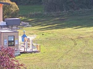
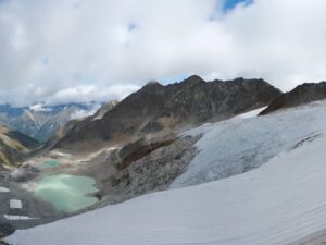
The Hintertux Glacier Webcam sits above the Sommerbergalm lift station at 2,100 meters (6,890 feet) and looks south across the ice of Austria’s only year-round ski area. The crevassed tongue of the glacier fills the middle of the frame, with bare rock ridges closing in from either side and the cable line of the Gletscherbus climbing away to the left. Below the ice the station buildings and a switchbacking service road sit on open pasture, green from about June to October and buried the rest of the year. Cloud builds fast against this ridge, so the glacier can be sharp in one shot and lost in grey an hour later.
Hintertux is the last settlement in the Tux valley, at 1,500 meters (4,921 feet) at the head of a road that runs south from Mayrhofen and stops at the glacier. The municipality of Tux had 1,924 residents at the 2021 census and appears in the written record in 1280 under the name Tukkes, so the valley was farmed for centuries before the lifts arrived. Most of what the camera shows is not the village, though, but the first stage of the lift system above it.
That first stage is Sommerbergalm, where this camera is mounted. The Gletscherbus 1 gondola covers the climb from the valley station at 1,501 meters (4,925 feet) to the alm in a little over four minutes, and two more Gletscherbus funitels with 24 person cabins carry on from there, by way of the Tuxer Fernerhaus at 2,660 meters (8,727 feet), to the Gefrorene Wand top station at 3,250 meters (10,663 feet). That gives the ski area a vertical range of 1,750 meters (5,741 feet) served by 20 lifts, and it is the height of the upper stages that keeps snow on the glacier through the summer.
The rock around the ice is high even by Tyrolean standards. Gefrorene Wand Spitze reaches 3,288 meters (10,787 feet) directly above the pistes, the Hoher Riffler stands at 3,231 meters (10,600 feet), and the Olperer, the peak that dominates the skyline east of the valley, tops out at 3,476 meters (11,404 feet). The Tuxer Joch, the saddle at 2,338 meters (7,671 feet) crossing west out of the valley, is the line most walkers take.
At the camera’s altitude the year is cold and long. Winter days average about 2 degrees below freezing, or 29 F, with nights near minus 10 C (15 F), and January is the hardest month, with typical highs of minus 3.5 C (26 F). Spring warms slowly: March to May averages 4 C (40 F) by day and minus 4 C (25 F) at night. Summer is the only genuinely mild stretch, with June to August highs around 15 C (60 F) and July the warmest month at 16 C (61 F). Autumn falls away quickly, from 11.5 C (53 F) highs in September to 2 C (36 F) in November.
Snowfall is what changes the Hintertux Glacier Webcam most. Around 5 meters (16 feet) falls in a typical year at this height, spread across every month except the deep summer, and the monthly total stays above 55 centimeters (22 inches) from November through May. July and August are close to snow free at 2,100 meters, so in high summer the frame splits cleanly: green pasture at the bottom, white ice above. Cloud sits on the ridge for long stretches in any season, and the lifts run 08:15 to 16:30, so the busiest picture is the middle of the day.
The most unusual thing at Sommerbergalm is underground. Spannagel Cave, reached on foot from the Spannagelhaus restaurant a short walk from the lift station, is the highest commercial cave in the Central Alps and, at roughly 10 kilometers (6.2 miles) of surveyed passage, the longest and largest marble cave in the range. Cut by meltwater off the glacier above, it can be visited only on a guided tour and stays open year round. Higher up, the Natur Eis Palast is a natural ice cave inside the glacier, open all year, with boat trips on the meltwater pool at its bottom.
On snow, Sommerbergalm is where most people start. Several blue runs drop from the alm toward the Tuxer Joch, which makes the ground right in front of this camera the beginners’ end of the mountain, while the 64 kilometers (39.8 miles) of piste above it split into 17.2 kilometers of easy, 35.1 kilometers of intermediate and 11.7 kilometers of difficult terrain. In summer the same lifts carry walkers, with the Tuxer Joch the standard objective from the alm, while the glacier skiing above is what makes Hintertux the only Austrian resort turning lifts 365 days a year.
Three more cameras worth opening after the Hintertux Glacier Webcam, two of them in Austria and one on another Alpine glacier.
At the head of the Tux valley in Tyrol, Austria, above the village of Hintertux at 1,500 meters (4,921 feet). Mayrhofen is down the same road to the north, and Innsbruck is the closest airport.
The camera looks south from Sommerbergalm at 2,100 meters (6,890 feet), over the Gletscherbus cable line and the station buildings to the crevassed tongue of the glacier. In summer the pasture in the foreground is green while the ice stays white.
Cold for most of the year. Winter highs sit near minus 2 C (29 F) and nights near minus 10 C (15 F), while July, the warmest month, averages 16 C (61 F). About 5 meters (16 feet) of snow falls in a typical year at the camera’s altitude.
Yes. Hintertux is the only ski area in Austria that runs lifts 365 days a year, because the pistes on the glacier reach 3,250 meters (10,663 feet) and hold snow through the summer. The runs at the camera’s own level melt out and reopen with the autumn snow.
From 1,500 meters (4,921 feet) at the valley station to 3,250 meters (10,663 feet) at the Gefrorene Wand, a vertical range of 1,750 meters (5,741 feet) served by 20 lifts.
The Gletscherbus 1 gondola runs from the valley station at 1,501 meters (4,925 feet) and takes a little over four minutes. Two further Gletscherbus funitels, with 24 person cabins, continue up past the Tuxer Fernerhaus at 2,660 meters (8,727 feet).
A marble cave a short walk from the lift station at Sommerbergalm, cut by glacial meltwater. It is the highest commercial cave in the Central Alps and, at about 10 kilometers (6.2 miles), the longest. Entry is by guided tour only, all year.
Source: feratel
The best new live webcams and site features, once a week.
By subscribing you agree to receive our weekly email. Unsubscribe any time.


 4.2°C / 39.6°F
 -0.8°C / 30.6°F