Live

 00:25:36
 10.2°C / 50.4°F
 Overcast Clouds
 83%
83% 7 km/h / 4 mph
 07:42
07:42 18:21
18:21Loading forecast…
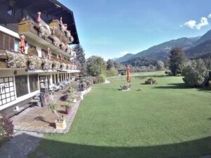
The Weissenbach am Lech Webcam looks out from the grounds of the Naturparkhotel Florence in Weissenbach am Lech, a village of 1,257 people in the Lech Valley of Tyrol, Austria. Flagpoles stand at the edge of the hotel forecourt in the foreground, and a mown meadow runs out to the village rooftops. Behind them, forested slopes climb to a bare rocky summit: the camera points toward the Thaneller, which rises to 2,341 meters (7,680 feet). A tall spruce frames the right side of the picture. The scene follows the seasons closely, with green meadows from late spring into autumn and snow on the roofs and the upper slopes in winter, and on clear afternoons the low sun picks out the rock faces of the peak.
Weissenbach am Lech sits at 885 meters (2,904 feet) in the Reutte district, about 10 kilometers (6.2 miles) from the district town of Reutte. It lies where the Tannheim Valley opens into the Lech Valley, and two streams, the Weissenbach and the Rotlech, join the Lech here. The municipality covers 81.85 square kilometers (31.6 square miles), much of it mountain and forest, and its only other locality is the hamlet of Gaicht, home to just 27 people.
The village first appears in a document from St. Mang Abbey in Fussen in the year 1200, and a Roman-era grave found at the Weissenbacher Oberhof points to far older settlement. In the Middle Ages the salt road from Hall in Tirol to the Lake Constance region ran through Weissenbach and over the Gaicht Pass, at 1,093 meters (3,586 feet). A road for salt and wine traffic between Tyrol and the Allgau was built over the pass around 1550, and the remains of a fort there date from 1632. The parish church of St. Sebastian, known for its altars and ceiling paintings, stands in the village, and seven chapels are scattered around it.
The hotel stands in a quiet, sunny spot about 200 meters (656 feet) from the village center. Down on the valley floor, the Lech is protected by the Tiroler Lech Nature Park, which covers around 40 square kilometers (15 square miles) along one of the last largely untamed wild rivers of the Northern Alps. Its gravel banks hold rare plants such as the German tamarisk and the lady’s slipper orchid, while stone crayfish and bullhead live in the river and common sandpipers nest along it.
The nearest long-term record comes from the GeoSphere Austria station in Reutte, at 853 meters (2,799 feet), only a little lower than the village. Averaged over 1991 to 2020, January has a mean of minus 1.9 C (29 F), with daytime highs around 3 C (38 F) and nights near minus 6 C (22 F). In winter snow often lies on the meadow and roofs in the frame, and the higher slopes of the Thaneller usually turn white before the valley floor does.
July averages 16.4 C (62 F), with afternoons around 22 C (72 F) and nights near 11 C (52 F), so the meadows stay green through the summer. Precipitation is generous: Reutte records 1,418.7 millimeters (55.9 inches) in a typical year, and August is the wettest month at 189.7 millimeters (7.5 inches), so low cloud can hide the peak entirely on some days. Spring and autumn give the camera its sharpest contrasts, with fresh snow on the summit rocks above a green or golden valley.
The Gaicht Pass is the classic outing from the village. The old pass road has been restored as a hiking route through the gorge, past the remains of the 1632 fort, and a trail continues over the old pass to the Haldensee in the Tannheim Valley. Hikers also climb from Weissenbach to the Gaichtspitze. Along the river, the Lechweg long-distance trail runs 125 kilometers (78 miles) from its source near the Formarinsee to the Lech Falls in the Allgau, and passes the mouth of the Rotlech gorge beside the village. The Lechausee, a lake of clear water ringed by untouched riparian forest, lies close by, and in summer the village adventure pool has a slide and sunbathing lawns.
Further along the valley, the Pflacher Au bird trail at Pflach has an 18 meter (59 foot) observation tower over the river meadows, and the Klimmbrucke Nature Park House in Elmen holds an interactive exhibition on the wild Lech. Back in Weissenbach, the Millers Miehl museum shows rural life and traditional crafts, and what is billed as the longest staircase in Tyrol leads up to an old iron ore tunnel. In winter the Moosberg lift serves families, and an illuminated sled run follows the Gaicht Pass road. Village events include the Lechlauf running race and the carnival, which keeps the old Zuderer custom alive.
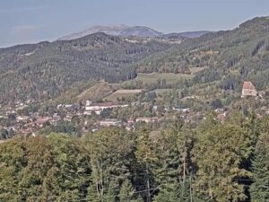
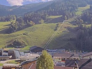
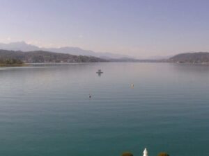
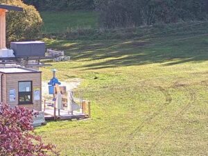
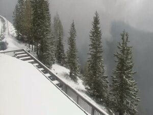
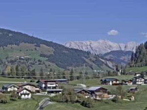
Two of these cameras watch other corners of Tyrol, and the third looks over an alpine village in the neighboring Allgau.
Weissenbach am Lech is in the Reutte district of Tyrol, in western Austria, about 10 kilometers (6.2 miles) from Reutte. It lies in the Lech Valley where the Tannheim Valley joins it, at the foot of the Gaicht Pass.
The camera looks across the hotel forecourt and a meadow to the village rooftops, with forested slopes and the rocky summit of the Thaneller behind them. A spruce fills the right edge of the frame.
Winters are cold, with a January mean of minus 1.9 C (29 F) at nearby Reutte, and summers are mild, with July averaging 16.4 C (62 F) and afternoons around 22 C (72 F). About 1,419 millimeters (55.9 inches) of precipitation falls in a typical year, most of all in August.
The camera faces the Thaneller, which reaches 2,341 meters (7,680 feet), roughly 1,450 meters (4,760 feet) above the village.
The village lies at 885 meters (2,904 feet), a little higher than Reutte at 853 meters (2,799 feet).
The Gaicht Pass, at 1,093 meters (3,586 feet), links the two valleys. On foot, the restored old pass road leads up through the gorge, and a trail continues over the old pass to the Haldensee.
Yes. The 125 kilometer (78 mile) Lechweg follows the river through the valley past Weissenbach on its way from the Formarinsee to the Allgau.
The Moosberg lift is a family-friendly ski lift in the village, and an illuminated sled run follows the Gaicht Pass road.
Source: Naturparkhotel Florence
The best new live webcams and site features, once a week.
By subscribing you agree to receive our weekly email. Unsubscribe any time.

 6.9°C / 44.4°F






 8.3°C / 46.9°F