Live

 22:18:20
 -13°C / 8.6°F
 Overcast Clouds
 84%
84% 19 km/h / 12 mph
 07:46
07:46 18:14
18:14Loading forecast…
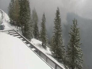
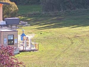
The Tiefenbach Glacier Webcam looks across Soelden’s glacier ski area from the Tiefenbach base station at 2,800 meters (9,186 feet) in the Otztal Alps of Tyrol, Austria. It is a rotating panorama camera, so one sweep runs from the lift buildings and piste machinery at the foot of the glacier, across the parking apron cut into the mountainside, and up to the rocky ridge that closes the basin. A second angle on this page sits higher, at the Schwarze Schneid mid station at 3,000 meters (9,843 feet), pointed down onto the ice itself, the turquoise meltwater pools that gather below it and the peaks beyond. Between them they cover the working end of the glacier and the snowfield above.
The Tiefenbachferner is one of two glaciers that carry lift-served skiing above Soelden, and the pisted part of it runs between 2,795 and 3,249 meters (9,170 and 10,659 feet). The lower camera sits at the bottom of that range, where the glacier road ends. At the top of it stands the resort’s best known structure, the BIG3 panorama footbridge on the Tiefenbachkogl: a 15 meter (49 foot) pyramid marks the platform, and a steel bridge clad in glass pushes 20 meters (66 feet) out over the edge, leaving a 60 meter (197 foot) drop to rock and piste below. It is one of three BIG3 viewing platforms on peaks above the resort, alongside the Schwarze Schneide at 3,340 meters (10,958 feet) and the Gaislachkogl at 3,048 meters (10,000 feet).
The Otztal Glacier Road, which the resort calls the highest asphalt road in the Eastern Alps, climbs from the village at 1,368 meters (4,488 feet) to more than 2,800 meters (9,186 feet) and passes through the Rosi Mittermaier tunnel on the way. It ends at the buildings in the lower camera’s frame, where the 600 seat Restaurant Tiefenbach Glacier stands, and a 200 meter (656 foot) ski tunnel bored through the ridge links this glacier with the neighboring Rettenbach. Between them the two glaciers hold 35.1 kilometers (21.8 miles) of marked slopes.
Soelden itself is unusual on paper. The municipality covers 466.89 square kilometers (180.27 square miles), which makes it the largest in Austria, yet only 2,955 people lived there at the 2021 count. Its ski area spans 1,350 to 3,250 meters (4,429 to 10,663 feet) with 33 lifts and 146 kilometers (91 miles) of marked terrain, topped by the glacier. When the air is clear the Wildspitze, the highest mountain in North Tyrol at 3,768 meters (12,362 feet), stands on the skyline.
At this height the year never really warms up. Reanalysis for the camera’s position puts average January highs near minus 7 C (20 F) with nights around minus 17 C (2 F), and April still averages a high a shade below freezing. Midwinter frames are mostly white on white, the station buildings and lift towers giving the only hard edges. Spring brings longer light and better definition: the pistes show up as graded lanes against rougher snow, and the rock ribs above the road start to darken as they shed cover.
Summer is the short exception. July averages a high near 10 C (50 F) and August about 12 C (53 F), with overnight lows barely above freezing, so the glacier surface softens and retreats without ever clearing. By late summer the ice is at its most exposed, protective sheeting goes down over the snowfield, and turquoise meltwater pools collect in the hollows below the Schwarze Schneid camera. October averages a high of roughly 3 C (37 F), which is when the snow starts to build again. Cloud is the real variable rather than temperature, and the cameras spend plenty of days inside it.
The obvious outing is the BIG3 rally, which strings together the three platforms above Soelden by lift: the footbridge at the Tiefenbachkogl, the Schwarze Schneide nature platform, and the Gaislachkogl. In summer three lifts run on the glacier, the Tiefenbachbahn and the Schwarze Schneidbahn I and II, so the high platforms stay reachable without skis. Drivers can take the Otztal Glacier Road up past 2,800 meters (9,186 feet) instead, and both glacier restaurants stay open through the season.
Walkers have real options from the top of the road. A path leads to the Braunschweiger Hutte at close to 2,800 meters (9,186 feet), and a high route runs across to the mountaineering village of Vent. Mountain bikers can pick up the Fernar Trail, a singletrack that starts at the Tiefenbach Glacier. Late October brings the loudest week of the year, when the Alpine Ski World Cup opens its season with a giant slalom on the Rettenbach glacier, a few minutes away through the ski tunnel.
These cameras cover similar high Alpine ground.
It lies above Soelden in the Otztal valley of Tyrol, western Austria, roughly 10 kilometers (6.2 miles) southwest of the village by the glacier road. Innsbruck is the nearest major city.
Two angles are wired to this page. The lower camera turns through a full panorama from the glacier base station at 2,800 meters (9,186 feet), taking in the lift buildings, the piste machinery and the ridge above. The higher one, at the Schwarze Schneid mid station, looks out over the ice, the meltwater pools and the surrounding Otztal peaks.
The main camera is at 2,800 meters (9,186 feet), at the foot of a pisted glacier that reaches 3,249 meters (10,659 feet). The second angle on this page is higher again, at 3,000 meters (9,843 feet).
Cold in every month. Average highs run near minus 7 C (20 F) in January and only about 12 C (53 F) in August, and snow is possible at any point in the year.
By the Otztal Glacier Road from Soelden, which climbs past 2,800 meters (9,186 feet) and passes through the Rosi Mittermaier tunnel. The Tiefenbachbahn gondola carries on up the glacier. In winter the high platforms are reached on skis or a snowboard.
The glacier lifts operate in summer, though the schedule is set by the resort each year. Across the Tiefenbach and Rettenbach glaciers there are 35.1 kilometers (21.8 miles) of marked slopes.
A glass clad steel walkway at the Tiefenbachkogl that projects 20 meters (66 feet) beyond the rock, with a 60 meter (197 foot) drop beneath it. A 15 meter (49 foot) pyramid marks the entrance, one of three BIG3 platforms above Soelden.
The Alpine Ski World Cup traditionally opens its season in late October with a giant slalom on the Rettenbach glacier, next door to the Tiefenbach and linked to it by a 200 meter (656 foot) ski tunnel.
Source: Soelden Livecams
The best new live webcams and site features, once a week.
By subscribing you agree to receive our weekly email. Unsubscribe any time.
 5.4°C / 41.7°F

 0.3°C / 32.5°F
 1.5°C / 34.7°F