
Live

 01:46:31
 0.6°C / 33.1°F
 Clear Sky
 89%
89% 1 km/h / 1 mph
 07:33
07:33 18:04
18:04Loading forecast…
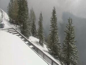
The Bad Kleinkirchheim Webcam looks south from Landhaus Apartments Praegant, a guesthouse at 1,100 meters (3,609 feet) in this Carinthian spa village, across to the lower slopes of the Kaiserburg. The Romerbad thermal spa and the valley station of the Kaiserburgbahn sit at the foot of the frame, roughly 300 meters (980 feet) from the camera. Above them a broad open run climbs between stands of spruce. Lines cut into the hillside belong to the Kaiserburg Bob, a toboggan run, and to the Flow Country Trail for mountain bikers. In winter the same clearing is a ski run that finishes beside the village rooftops. In summer it turns green, and the gravel tracks stand out pale against the grass.
Bad Kleinkirchheim lies in a 5 kilometer (3.1 mile) glacial trough valley in the Nock Mountains, part of the Gurktal Alps, between Lake Millstatt and the upper Gurk River. The village center sits at 1,087 meters (3,566 feet). The municipality covers 74 square kilometers (28.6 square miles) and had 1,723 residents in 2018. Its highest point is the Klomnock at 2,331 meters (7,648 feet), and part of the protected Nockberge landscape falls inside its boundaries. The B88 road follows the valley, linking Radenthein to the west with Reichenau to the east.
The place first appears in a deed by Archbishop Conrad II dated 5 July 1166, and the parish church of St. Ulrich was built around 1492. Its fortunes rest on warm water. Thermal water rises from more than 1,000 meters (3,281 feet) underground and reaches the surface at around 36 C (97 F), and in 1973 the village added “Bad”, the German word for spa, to its name. It now supports two spas: the Romerbad in front of the camera and Therme St. Kathrein in the village.
Skiing is the other half of the story. The ski area climbs from 1,087 meters (3,566 feet) to the 2,055 meter (6,742 foot) summit of the Kaiserburg, and the Bad Kleinkirchheim Webcam frames the bottom of that mountain. The first stage of the Kaiserburgbahn, a six-seat gondola built in 1986, rises from 1,070 meters (3,510 feet) to 1,363 meters (4,472 feet). Franz Klammer, the Austrian downhill great, won his first European Cup downhill here in 1971 on the K70 course, and Alpine Skiing World Cup races are often held in the resort.
At 1,100 meters (3,609 feet) the valley has a proper Alpine winter. Long-term averages for 1996 to 2025 put daytime highs at about 1 to 3 C (34 to 37 F) from December through February, with nights falling to around -6 C (21 F). Snowfall is concentrated between November and April, and December, January and February are the snowiest months, so through the ski season the slope on camera is usually white. Spring comes late at this height. April highs reach only about 10 C (50 F), with nights hovering just above freezing, and May brings the first properly mild days at around 15 C (59 F).
Summer is mild rather than hot. July and August highs average about 21 C (70 F), and nights stay near 11 C (52 F). By then the run is green, and the toboggan track and the bike trail are the clearest features on the hillside. September cools to highs around 16 C (61 F) and October to about 12 C (54 F), usually still dry enough for hiking. The first snow tends to return in November, when highs drop to around 6 C (43 F) and nights sit close to 0 C (32 F).
The Romerbad is about a three minute walk from the camera’s position. Its 872 square meters (9,386 square feet) of water include an indoor pool, an outdoor panorama pool, a whirlpool and a children’s pool, with the thermal water kept at 31 to 34 C (88 to 93 F). There are also 13 saunas and steam baths spread over three levels. Therme St. Kathrein, on Dorfstrasse, is the family choice, with 1,200 square meters (12,917 square feet) of water and an 86 meter (282 foot) slide.
On the hillside in the frame, the Kaiserburg Bob runs 1.4 kilometers (0.9 miles) through 26 curves. The Flow Country Trail starts at the Kaiserburgbahn top station at 2,055 meters (6,742 feet) and winds about 15 kilometers (9.3 miles) through forest and meadow, dropping 910 vertical meters (2,986 feet) to the valley. It ranks among the longest flow trails in Europe. The lift also carries hikers up into the Nock Mountains, and the village has its own golf course, the Golfarena Bad Kleinkirchheim. In winter the open slope you see on screen is a ski run that ends at the valley station.
For more Alpine ski country, try one of these next.
Bad Kleinkirchheim is in Carinthia, the southernmost state of Austria, in the Spittal an der Drau district. It sits in a valley of the Nock Mountains between Lake Millstatt and the upper Gurk River, on the B88 road between Radenthein and Reichenau.
The camera looks south from Landhaus Apartments Praegant toward the Kaiserburg. The Romerbad thermal spa and the Kaiserburgbahn valley station sit at the bottom of the frame, with the ski slope, the Kaiserburg Bob and the Flow Country Trail on the forested hillside behind them.
Winters are cold and snowy, with highs of about 1 to 3 C (34 to 37 F) and nights near -6 C (21 F). Summers are mild, with highs around 21 C (70 F) in July and August and cool nights near 11 C (52 F).
The live picture is the quickest way to check. Snowfall in the valley is concentrated between November and April, with the most in December, January and February.
The village center lies at 1,087 meters (3,566 feet), and the camera is at about 1,100 meters (3,609 feet). The ski area tops out at 2,055 meters (6,742 feet) on the Kaiserburg.
The water rises from more than 1,000 meters (3,281 feet) underground and reaches the surface at around 36 C (97 F). In the Romerbad pools it is kept at 31 to 34 C (88 to 93 F).
The Kaiserburg Bob is 1.4 kilometers (0.9 miles) long with 26 curves. Its track runs down the hillside in full view of the webcam.
Source: Landhaus Apartments Praegant
The best new live webcams and site features, once a week.
By subscribing you agree to receive our weekly email. Unsubscribe any time.
 4°C / 39.2°F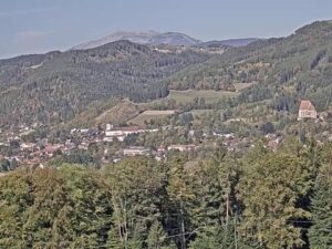






 14.1°C / 57.4°F