
Live

 00:11:50
 7.4°C / 45.3°F
 Overcast Clouds
 85%
85% 2 km/h / 1 mph
 07:20
07:20 18:29
18:29Loading forecast…







CPA Delfín - Zimní stadion, Lipová, Uhersky Brod, Czechia
 7.4°C / 45.3°F
00:11
7.4°C / 45.3°F
00:11
Madrigal de las Altas Torres, Avila, Spain
 15.8°C / 60.4°F
00:11
15.8°C / 60.4°F
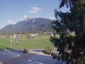
00:11The Embach Webcam looks north-northeast from Embach, a farming village on a high plateau above the Salzach valley in the Austrian state of Salzburg. Farmhouses, chalets and green meadows fill the foreground, crossed by a narrow lane, and a forested ridge rises on the left. Through a gap in the hills, the pale limestone walls of the Hochkoenig stand on the horizon about 15 kilometers (9 miles) away. The camera faces away from the sun, so around midday the light falls straight onto that rock, and on a clear day it shows up almost white against the sky. Low cloud can hide the massif completely while the village below stays clear, and snow, autumn color and the spring green of the fields change the scene through the year.
Embach is a village in the municipality of Lend, in the Pinzgau region and the district of Zell am See, and it has belonged to Lend since 1938. It sits on a plateau at 1,013 meters (3,323 feet), roughly 300 meters (1,000 feet) above the Salzach, which flows along the valley floor about a kilometer (0.6 miles) north of the village. The river never appears on camera: the meadows in the middle of the frame drop away into the valley, and the slopes beyond them belong to its far side. Embach had 269 residents at the start of 2026.
The Salzburg tourist board describes Embach as the biggest village of farmhouses in SalzburgerLand, and the camera bears that out. Instead of a tight center, the houses spread across the plateau in loose clusters with wide fields between them, many of them with long wooden balconies. The forested ridge on the left of the picture lies around 3.5 kilometers (2 miles) away across the valley, with clearings and farms scattered over its lower slopes.
The mountain in the gap is the Hochkoenig, whose summit reaches 2,941 meters (9,649 feet). From Embach the camera sees its broad southern side, a wall of grey limestone rising well above the tree line, with a row of sharper towers along the ridge to the right. It also lends its name to the Hochkoenig ski region, one of several within 40 kilometers (25 miles) of the village.
At just over 1,000 meters, Embach gets a full Alpine winter. Climate averages for the plateau’s height over 2015 to 2024 put January highs at about 2 C (36 F) and nights near -7 C (19 F), with February only slightly milder. After a snowfall the meadows, the roofs and the Hochkoenig can all turn white at once. Spring comes slowly: April afternoons reach about 12 C (53 F) with nights close to freezing, and the high limestone typically keeps its snow long after the fields below have turned green.
Summer is mild and fairly wet. July and August highs average about 23 C (73 F), with nights of 11 to 12 C (52 to 54 F), and May through August each bring around 140 to 155 millimeters (5.5 to 6 inches) of rain, part of roughly 1,400 millimeters (55 inches) a year. September highs average about 18 C (65 F) and October about 14 C (58 F). In early October the broadleaf trees around the village turn yellow while the meadows are still green, and by November highs drop to around 8 C (47 F).
Summer on the plateau is about walking, cycling and farm life. Hiking and mountain biking routes cross the plateau, and a 6-kilometer (3.7-mile) mountain golf course runs across it as well. Equestrian Embach offers horse riding, and the Hoadabauer farm keeps a herb garden with a seminar kitchen, where it runs herb tours and workshops. The parish church of St. Lawrence stands in the village, and the pilgrimage chapel of Maria Elend is one of the oldest pilgrimage sites in the Pinzgau. Two smaller chapels, the Oelbergkapelle and the mountain chapel of St. Sebastian, complete the set.
In winter, the Hoerndl is Embach’s own small ski area, with a tow lift and a beginner lift, a toboggan run, and snowshoe and winter hiking trails. It suits children learning to ski more than anyone looking for long runs, and cross-country trails lead out to the Maria Elend chapel. For bigger terrain, several major areas lie within about 40 kilometers (25 miles): the Rauriser Hochalmbahnen in the Rauris valley, the Gasteiner Bergbahnen in the Gastein valley, the Hochkoenig ski region, the Kitzsteinhorn glacier above Kaprun, the Schmittenhoehe at Zell am See and the Skicircus Saalbach Hinterglemm Leogang Fieberbrunn. The village also lies in the Hohe Tauern National Park region.
Three more Austrian Alpine cameras, from Salzburg’s own city mountain to the peaks of Tyrol:
Embach is in the state of Salzburg, in the Pinzgau region and the district of Zell am See. It is part of the municipality of Lend and sits on a plateau above the Salzach valley, in the Hohe Tauern National Park region.
The camera looks north-northeast over the farmhouses and meadows of Embach. A forested ridge on the far side of the Salzach valley fills the left of the frame, and the limestone Hochkoenig massif rises on the horizon in the middle, about 15 kilometers (9 miles) away. A small wooded rise closes off the right side.
The big rock face on the horizon is the Hochkoenig, a limestone massif whose summit reaches 2,941 meters (9,649 feet). The camera sees its southern side through a gap between the nearer hills, and around midday the sun lights the rock directly.
No. The Salzach runs along the valley floor about a kilometer (0.6 miles) north of the village and roughly 300 meters (1,000 feet) lower, hidden below the edge of the meadows. Lend, the municipality’s main village, lies down by the river and is out of sight as well.
The village sits at about 1,013 meters (3,323 feet) on a plateau high above the Salzach valley. Heights vary a little across the plateau, and some sources give 1,017 meters (3,337 feet).
Winters are cold, with January highs around 2 C (36 F) and nights near -7 C (19 F). Summers are mild, with July and August highs around 23 C (73 F), and May to August are the wettest months. The camera works as a quick check before a trip: if the Hochkoenig is in view, the mountains are clear of low cloud.
Yes, on a small scale. The Hoerndl ski area in the village has a tow lift and a beginner lift, plus a toboggan run and snowshoe trails, which suits families with young children. Larger ski areas in Rauris, Gastein, Kaprun, Zell am See and the Hochkoenig region are all within about 40 kilometers (25 miles).
Source: TVB Embach
The best new live webcams and site features, once a week.
By subscribing you agree to receive our weekly email. Unsubscribe any time.