English
 简体中文
 Deutsch
 Français
 Español
 Nederlands
 Svenska
 Italiano
 日本語
 Polski
 Português
 Русский
 Ελληνικά
 العربية
 Türkçe
Live
 10:36:04
 -3°C / 26.6°F
 Clear Sky
 58%
 4 km/h / 2 mph
 06:38
 17:00
Loading forecast…



Wolf Creek Ski Area, U.S. 160, Pagosa Springs, CO, USA
 -4.2°C / 24.4°F
10:36


Stocker Stadium, Lincoln Park, Colorado, USA
 5.3°C / 41.5°F
10:36

Colorado College, East Cache La Poudre Street, Colorado Springs, CO, USA
 11.1°C / 52°F
10:36
Steamboat Ski Resort, Steamboat Springs, Colorado, USA
2.4°C / 36.3°F
10:36
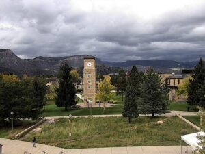
Fort Lewis College, Durango, Colorado, USA
4.4°C / 39.9°F
10:36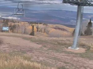
Sunlight Mountain, Garfield County, Colorado, USA
-1.3°C / 29.7°F
10:36
The Beaver Creek Webcam sits near the top of Beaver Creek Mountain at 11,420 feet (3,481 meters) and looks north-northeast across the Eagle River valley to the Gore Range. Eagle County runs the camera, and its picture is all skyline: a long, jagged wall of peaks with Mount Powell, the highest summit in the range, near the middle of the frame and the sharp point of Eagles Nest to its left. Below the peaks, layer after layer of forested ridges fold down toward the valley, patched with clearings and paler stands of timber. In winter the whole range turns white, and on clear days the snow on the summits stands out against a deep blue sky.
Beaver Creek Resort opened for the 1980-81 ski season above the town of Avon and is now owned by Vail Resorts. Its lifts climb from a base village at 8,100 feet (2,469 meters) to a top elevation of 11,440 feet (3,487 meters), a vertical drop of 3,340 feet (1,018 meters) across 2,082 acres (843 hectares) of skiable terrain served by 24 lifts. The county’s camera stands only a few feet below that top, high enough to see over the intervening ridges to the Gore Range more than 25 kilometers (16 miles) away.
The resort is best known for racing. It hosted the FIS Alpine World Ski Championships in 1989, 1999 and 2015, and its Birds of Prey course holds World Cup downhill races early in each season. Avon, the gateway town about 2 miles (3 kilometers) north of the resort, sits at 7,430 feet (2,265 meters) and had 6,072 residents at the 2020 census.
The peaks across the valley belong to the Gore Range, named for Sir St George Gore, an Irish hunter who visited the area in the 1850s. Mount Powell reaches 13,566 feet (4,135 meters) and stands about 26 kilometers (16 miles) from the camera, with Eagles Nest a little farther away on its left. Many other summits in the range reach around 13,000 feet (3,960 meters). Large parts of the range lie inside the Eagles Nest Wilderness, and its southern end comes down to Gore Creek at Vail, where Interstate 70 runs along its lower flanks toward Silverthorne.
At 11,420 feet the camera sits in a cold, high-mountain climate. Weather data for this elevation from 2015 to 2024 averages January highs of about -7°C (19°F) and lows near -17°C (1°F), and average daytime highs stay below freezing from November through March. Storms can drop the cloud base below the camera and hide the Gore Range completely, then clear to show the whole range freshly whitened. When this post was written in early November, the peaks were already snowy while the airfield at Eagle County Regional Airport, far down the valley, was still bare.
Summer at this height is short and cool. July highs average about 17°C (63°F), with nights around 3°C (37°F), so a frost is possible even in midsummer. April and October sit close to freezing by day, about 1°C (34°F) and 5°C (41°F) on average, and both months can bring snow. June and September frame the warm season, both with average highs of about 13°C (55°F).
In winter, Beaver Creek’s slopes are the obvious draw, from the 2.75 mile (4.4 kilometer) Centennial run, the longest on the mountain, to the Birds of Prey course used by the World Cup racers. Down in Avon, Nottingham Lake has a beach with paddleboard and pedal boat rentals in summer, and the neighboring Harry A. Nottingham Park hosts a summer concert series and an annual art festival.
The Gore Range on the camera is reached through the Eagles Nest Wilderness, which covers much of its high country, and Interstate 70 between Vail and Silverthorne gives road views of its lower flanks. On the east side of the range, Buffalo Mountain at its southern end is visible from Dillon Reservoir. To the west, the Eagle River valley leads down past Eagle to Eagle County Regional Airport near Gypsum.
These cameras show more of the Colorado high country.
Beaver Creek is a ski resort in Eagle County, central Colorado, about 2 miles (3 kilometers) south of Avon. The camera is near the top of Beaver Creek Mountain, at 11,420 feet (3,481 meters).
The camera looks north-northeast across the Eagle River valley to the Gore Range, with Mount Powell near the center of the frame, Eagles Nest to its left and a line of jagged peaks running off to the right above layers of forested ridges.
At the camera’s height, January highs average about -7°C (19°F) and lows about -17°C (1°F), and highs stay below freezing from November through March. July highs reach about 17°C (63°F). The base village at 8,100 feet (2,469 meters) is milder than the summit.
From the top of Beaver Creek Mountain the camera faces the Gore Range. Its highest summit, Mount Powell at 13,566 feet (4,135 meters), sits near the middle of the view about 26 kilometers (16 miles) away, with Eagles Nest beside it.
No. It is aimed over the valley at the Gore Range, so the frame is filled with distant peaks and forested ridges rather than lifts or groomed runs.
The ski area tops out at 11,440 feet (3,487 meters) and its base village sits at 8,100 feet (2,469 meters), a vertical drop of 3,340 feet (1,018 meters). The camera is at 11,420 feet (3,481 meters).
Beaver Creek hosted the FIS Alpine World Ski Championships in 1989, 1999 and 2015, and its Birds of Prey course stages World Cup downhill races early in the season.
Source: Eagle County Government
The best new live webcams and site features, once a week.
By subscribing you agree to receive our weekly email. Unsubscribe any time.
 2.4°C / 36.3°F