Live
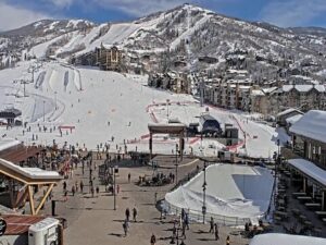
Steamboat Ski Resort, Colorado
Steamboat Ski Resort, Steamboat Springs, Colorado, USA
 5°C / 41°F
 15:07
15:07 15:07:32
 7.8°C / 46°FClear Sky
 46%
46% 10 km/h / 6 mph
 07:13
07:13 18:24
18:24Loading forecast…
Steamboat Ski Resort, Steamboat Springs, Colorado, USA
5°C / 41°F
15:07
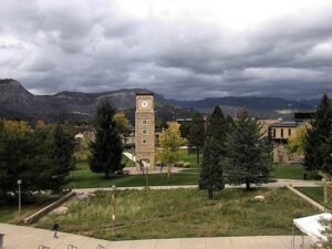
Fort Lewis College, Durango, Colorado, USA
15.2°C / 59.4°F
15:07



Sunlight Mountain, Garfield County, Colorado, USA
 5.2°C / 41.4°F
15:07
5.2°C / 41.4°F
15:07
Grand Avenue, Glenwood Springs, Colorado, USA
9.3°C / 48.7°F
15:07


Colorado College, East Cache La Poudre Street, Colorado Springs, CO, USA
 8.2°C / 46.8°F
15:07
8.2°C / 46.8°F
15:07
The Pole Creek Golf Club Webcam looks southeast across the Meadow nine at Pole Creek, a 27-hole public course in Grand County, Colorado, about 5 kilometers (3.2 miles) west of the village of Tabernash. A paved cart path curls past two benches just below the camera, a shingled roof edges into the right of the frame, and beyond a line of aspens and evergreens the fairways run out toward a distant ridge. That ridge is the Continental Divide, and the club names James Peak and Parry Peak as the summits on its skyline. The scene follows the mountain calendar closely: green fairways in summer, bare aspens by mid-October, a course buried in snow through winter. Cloud can hide the Divide for hours, then lift to show the high peaks again.
Pole Creek belongs to the Fraser Valley Metropolitan Recreation District and is the only public 27-hole course in Grand County, one of just a few in Colorado. Denis Griffiths designed it as three nines, the Meadow, the Ranch and the Ridge, each a par 36. The club lists the course at 6,499 meters (7,107 yards), with water in play on two ponds and five lakes. The Ridge nine climbs the most and holds the highest point on the property at 2,686 meters (8,812 feet), while the clubhouse area sits at roughly 2,620 meters (8,600 feet). Pole Creek, the stream that feeds those ponds and lakes, runs east past the clubhouse toward Tabernash.
The course earned national attention early. Golf Digest named it the Best New Public Golf Course in 1985, and the magazine’s 1995 guide to America’s 500 best places to play ranked it first in Colorado. Colorado Avid Golfer named it the state’s Best Mountain Golf Course every year from 2013 to 2016 and again from 2020 to 2022, and in 2017 Golf Advisor ranked it first in Colorado and 28th in the nation.
The camera faces the high country head on. James Peak and Parry Peak, both above 4,000 meters (13,100 feet), stand about 23 kilometers (14 miles) to the southeast on the Continental Divide, and Parry Peak is the same summit that rises behind Winter Park. The town of Fraser lies 8.5 kilometers (5.3 miles) away in roughly the same direction, down on the valley floor. Closer in, a few buildings and the tree line at the far edge of the course break up the open fairways.
This is one of the colder corners of Colorado. The official weather station in nearby Fraser, a town that calls itself the Icebox of the Nation, averages January highs of about -1 C (31 F) and lows near -18 C (-1 F) over the 1991 to 2020 normals. July brings highs around 25 C (77 F), yet nights still fall to about 3 C (38 F), so mornings start cold even in midsummer.
The same station records about 364 centimeters (143 inches) of snow a year, which on camera means a white course for months, with the Divide holding its snow longer still. The shoulder seasons are short. Ten years of weather model data for the course itself put average afternoons in May and October near 11 C (52 F), with frost on most nights in both months. By mid-October the aspens below the camera can already be bare while the fairways are still green.
Summer visitors come for the golf, and tee times on all three nines can be booked through the club. Bistro 28, the restaurant in the clubhouse, runs a winter season as well as a summer one. Once the snow arrives the valley turns to cross-country skiing. Devil’s Thumb Ranch in Tabernash grooms nearly 120 kilometers (75 miles) of Nordic trails in the Ranch Creek valley at the foot of the Continental Divide, and Snow Mountain Ranch, run by the YMCA of the Rockies, keeps close to 100 kilometers (62 miles) of groomed track for both classic and skate skiing.
The Fraser River Trail covers 10.1 kilometers (6.3 miles) between Fraser and Winter Park alongside US 40, a way to link the two towns by bike without riding on the highway. At its southern end, Winter Park Resort, 108 kilometers (67 miles) west of Denver, is the valley’s big ski area, set below Parry Peak and the peaks the camera looks toward.
For more Colorado high country and golf courses under big mountain ranges, try these cameras.
Pole Creek Golf Club is at 6827 County Road 51 in Grand County, Colorado, about 5 kilometers (3.2 miles) west of Tabernash and 8.5 kilometers (5.3 miles) northwest of Fraser. Denver is about 126 kilometers (78 miles) away to the southeast.
The camera looks southeast over a curving cart path, two benches and a line of aspens to the fairways of the Meadow nine, with forest, a few buildings and the Continental Divide on the horizon.
James Peak and Parry Peak on the Continental Divide, both more than 4,000 meters (13,100 feet) high and about 23 kilometers (14 miles) away. Low cloud can hide them for hours at a time.
Winters are long and cold and summers are mild. Nearby Fraser averages January lows near -18 C (-1 F) and July highs around 25 C (77 F), with about 364 centimeters (143 inches) of snow a year.
The clubhouse area sits at about 2,620 meters (8,600 feet), and the course rises to 2,686 meters (8,812 feet) at its highest point on the Ridge nine.
Twenty-seven, played as three par-36 nines called the Meadow, the Ranch and the Ridge. It is the only public 27-hole course in Grand County.
Denis Griffiths designed the course, and Golf Digest named it the Best New Public Golf Course in 1985.
Yes. The camera keeps streaming after the course closes for the season, so through the winter it shows the fairways under snow and the Divide white on the skyline.
Source: Pole Creek Golf Club
The best new live webcams and site features, once a week.
By subscribing you agree to receive our weekly email. Unsubscribe any time.
 4.2°C / 39.6°F