
Live

 11:46:50
 16.7°C / 62.1°F
 Overcast Clouds
 54%
 3 km/h / 2 mph
 07:17
 18:11
Loading forecast…

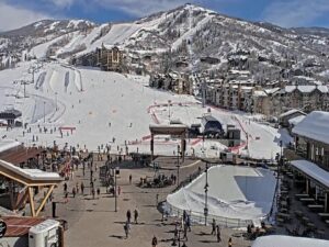
Steamboat Ski Resort, Steamboat Springs, Colorado, USA
 5.5°C / 41.9°F
11:46


Wolf Creek Ski Area, U.S. 160, Pagosa Springs, CO, USA
 1.8°C / 35.2°F
11:46
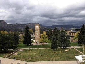
Fort Lewis College, Durango, Colorado, USA
 11°C / 51.8°F
11:46
Grand Avenue, Glenwood Springs, Colorado, USA
 10.6°C / 51.1°F
11:46


Glacier Club, San Juan Mountains, Colorado, USA
9.2°C / 48.6°F
11:46
Colorado College, East Cache La Poudre Street, Colorado Springs, CO, USA
17°C / 62.6°F
11:46

Sunlight Mountain, Garfield County, Colorado, USA
2.9°C / 37.2°F
11:46The Denver Webcam looks north-northwest from an office building in Greenwood Village, across miles of tree-covered neighborhoods to the downtown Denver skyline about 16 kilometers (10 miles) away. Behind the towers, the foothills and peaks of the Front Range run along the left half of the horizon, while to the right the land flattens out toward the plains. Boesen Law, the personal injury firm that streams the camera from its offices, adds an AccuWeather panel in the lower left corner with the temperature, the day’s high and low, the feels-like figure, the sky condition, the chance of precipitation and the wind. That makes it as much a weather camera as a city view. Haze thickens over downtown, clouds build over the mountains, and on clear days the skyline stands out against the foothills.
Denver is the capital and largest city of Colorado, founded in 1858 during the gold rush and home to 715,522 people at the 2020 census. Its Mile High City nickname is literal. The official elevation of 1,609 meters (5,280 feet) is fixed by a benchmark on the west steps of the Colorado State Capitol, and those steps carry three different markers. The 15th step was engraved “One Mile Above Sea Level” first. A second marker went into the 18th step after Colorado State University students resurveyed the elevation in 1969, and modern measurements in 2003 put the true mile on the 13th step, where a third marker sits. The Capitol opened in November 1894, built of Colorado white granite, and its dome has carried real gold leaf since 1908 in memory of the gold rush.
The camera sits well outside all of that. Greenwood Village is a separate city of 15,691 people in Arapahoe County, and it takes in part of the Denver Technological Center, the business district where Boesen Law has its office. The city stands at about 1,717 meters (5,633 feet), a little over 100 meters (about 350 feet) higher than downtown, which helps the camera see over the treetops all the way to the city center.
The main cluster of downtown towers sits just right of center in the frame, with a smaller group of high-rises farther left and a white mid-rise block much closer in on the right. In the foreground, a red brick church with a white steeple and a wide road with passing cars fill the bottom right corner. Everything else below the horizon is tree canopy with rooftops showing through it.
Denver has four distinct seasons and plenty of day-to-day swing. At Denver International Airport, the 1991 to 2020 normals give January highs of about 7 C (45 F) and lows near -7 C (19 F), with around 124 centimeters (49 inches) of snow in a typical year. Chinook winds bring periods of milder weather through the winter, so a cold, snowy week can turn into a mild one quickly. April warms to highs near 16.5 C (62 F), with lows around 1 C (34 F).
July highs average about 32 C (90 F), with lows near 16 C (60 F), and summer brings occasional afternoon thunderstorms, some of them severe. Hail comes with a few: Denver has had three of the ten costliest hailstorms in United States history. Because the camera faces the mountains, clouds building over the foothills are easy to follow on the left of the frame. October averages highs of 18.5 C (65 F) and lows near 3 C (37 F), and by early in the month the tree canopy in the foreground starts turning gold and red.
Close to the camera, Fiddler’s Green Amphitheatre in Greenwood Village is an 18,000-seat outdoor concert venue. Downtown, you can stand on the 13th step of the State Capitol’s west entrance for the measured mile, then walk through Civic Center Park to the Denver Art Museum. Larimer Square, Union Station and Coors Field, the Colorado Rockies’ ballpark, are all within walking distance of each other in Lower Downtown.
In the Front Range foothills west of the city, Red Rocks Amphitheatre in Morrison seats 9,525 people in a natural bowl between two huge sandstone formations, Ship Rock and Creation Rock.
Two more Colorado cameras and another American skyline:
A long view north-northwest from Greenwood Village to downtown Denver, about 16 kilometers (10 miles) away. The skyline sits just right of center, the Front Range runs along the horizon behind it, and the foreground is a dense canopy of trees over homes, with a church steeple and a road in the bottom right corner. It is a distant skyline view, not a street camera, so cars and people downtown are too small to make out.
No. Boesen Law runs it from its office building in the Denver Technological Center in Greenwood Village, a separate city in Arapahoe County south-southeast of Denver. The camera looks back toward downtown from there, which is why the towers appear as a compact cluster on the horizon rather than filling the frame.
Yes, on clear days. The foothills and higher peaks of the Front Range line the horizon across the left side of the frame and behind the skyline. Haze or low cloud can hide them completely, and they drop out of sight after dark.
No. The airport is roughly 32 kilometers (20 miles) from downtown, out on the plains northeast of the city and well outside this view. Coors Field is in Lower Downtown, so it sits somewhere inside the distant skyline, but at this range the ballpark cannot be picked out.
Two places to read it. The camera image carries its own AccuWeather panel with the temperature, the day’s high and low, the feels-like figure, the sky condition, the chance of precipitation and the wind speed. This page adds a second readout with local time, Celsius and Fahrenheit, and the sunrise and sunset times. Denver runs on Mountain time.
Yes. Boesen Law describes it as a 24/7 stream, and the weather panel on the image shows its own clock and updates with it. With the mountains in view, it works well for watching weather arrive: clouds stacking up over the foothills on summer afternoons, haze settling over downtown, or snow closing in until the skyline disappears.
Its official elevation is one mile, 1,609 meters (5,280 feet), set by a benchmark on the west steps of the Colorado State Capitol. The 13th step carries the marker from the 2003 survey.
Source: Boesen Law
The best new live webcams and site features, once a week.
By subscribing you agree to receive our weekly email. Unsubscribe any time.
 1.5°C / 34.7°F
 17.3°C / 63.1°F