
Live

Stream hours: Live 24 hours a day, in infrared black and white from about 7 pm to 6 am Kenya time. When the player shows clips marked HIGHLIGHT, the live view is paused and comes back on its own.
 10:43:06
 24.8°C / 76.6°F
 Few Clouds
 60%
 3 km/h / 2 mph
 06:07
 18:18
Loading forecast…
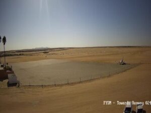
Swakopmund Municipal Aerodrome, Swakopmund, Namibia
 16.3°C / 61.3°F
09:43
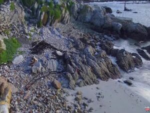
Stony Point Nature Reserve, Wallers Road, Betty's Bay, South Africa
 15.8°C / 60.4°F
09:43


Jetty 1905 Restaurant, On the Jetty Bridge, Swakopmund, Namibia
15.8°C / 60.4°F
09:43

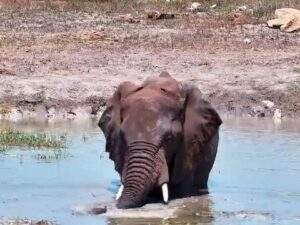
Tau Game Lodge, Madikwe, North West, South Africa
25.6°C / 78.1°F
09:43
Bloubergstrand Beach, Marine Drive, Cape Town, South Africa
17.2°C / 63°F
09:43
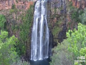
Kwa Maritane, Pilanesberg, North West, South Africa
26.9°C / 80.4°F
09:43
Kasugho, Lubero, North Kivu, DR Congo
 24.6°C / 76.3°F
09:43
Tembe Elephant Park, KwaZulu-Natal, South Africa
24.8°C / 76.6°F
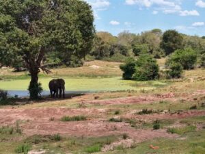
09:43The Chyulu Hills Webcam looks across the waterhole in front of ol Donyo Lodge, on Maasai-owned ranchland on the western side of the Chyulu Hills in southern Kenya. The camera sits almost at ground level. Red earth and dark clods fill the foreground, the muddy pool lies in the middle of the frame, and acacia bush with flat-topped umbrella thorns closes off the far side. Elephants walk right up to the lens, close enough to fill much of the picture, while Masai giraffes often stand on the far bank against the sky. In the dry season the ground is bare and rust colored, and after the rains the same patch turns green. The stream runs on the Africam channel and carries the logo of Great Plains, the company that runs the lodge. It is live around the clock, in infrared black and white from about 7 pm to 6 am Kenya time, though at times recorded clips marked HIGHLIGHT play instead until the live picture returns on its own.
The Chyulu Hills are a volcanic field about 100 kilometers (62 miles) long, made of several hundred small cones and lava flows that divide the Tsavo plains from the Amboseli plains. The highest point reaches 2,188 meters (7,178 feet). This is young volcanic ground: the last eruptions, at the Shaitani and Chaimu cones, are dated to 1856, and the Leviathan Cave runs for about 11 kilometers (6.8 miles) through the lava. Chyulu Hills National Park was gazetted in 1983 and covers 741 square kilometers (286 square miles) as a northwestern continuation of Tsavo West National Park. Water from the hills feeds the Tsavo and Galana rivers and Mzima Springs.
The camera is outside the park. ol Donyo Lodge stands on the Mbirikani Group Ranch, about 1,113 square kilometers (430 square miles) of land in Kajiado County owned by some 4,000 Maasai, and the ranch lies on traditional wildlife migration routes between Tsavo and Amboseli. Bush pilot and conservationist Richard Bonham built the first lodge here in 1987, an early example of a lodge leasing its land from a Maasai community, and it was redesigned in 2008. Great Plains runs it today, and the lodge contributes to the conservation work of Big Life.
The lodge looks out toward Kilimanjaro, about 77 kilometers (48 miles) to the southwest. A waterhole lies in front of the main area, with two hides beside it, one of them sunk into the ground. The Chyulu Hills Webcam has a similar low point of view, so an elephant at the pool looks enormous on screen.
At about 1,200 meters (3,940 feet), the ranch around the lodge is warm rather than hot. Daytime highs stay between 25 and 28 C (77 and 83 F) in every month of the year, with February, March and October the warmest. From January to April the nights hold at 17 to 18 C (63 to 64 F), and from June to September they fall to around 15 C (59 F). Those months are also the long dry season, with almost no rain, and the ground in front of the camera dries to bare red earth. This is when the waterhole typically draws the most animals.
Two rainy seasons reach the hills. The long rains peak in April, at around 135 millimeters (5.3 inches) for the month, and the short rains bring the wettest spell of the year in November and December, with November averaging about 150 millimeters (5.9 inches). Across a full year the total comes to roughly 680 millimeters (27 inches). After the rains, grass covers the mud around the waterhole and water collects elsewhere on the ranch, so visits to this pool tend to drop off.
Most of what there is to do starts at the lodge. It runs open-vehicle game drives and night drives on the ranch, guided walking safaris, mountain biking, and horseback safaris for intermediate and advanced riders. Guests can sleep out on rooftop star beds, sit in the waterhole hides, or go with a guide to a Maasai village, a local market or a school. Helicopter safaris are also offered.
Further afield, Tsavo West National Park covers 9,065 square kilometers (3,500 square miles) on the other side of the hills. Its Mzima Springs, a series of natural springs and pools fed by water from the Chyulus, is famous for its hippos and crocodiles. Amboseli National Park lies to the west across the plains, below Kilimanjaro. Scheduled light aircraft land at the ol Donyo airstrip, a 30-minute transfer from the lodge.
Three more African waterholes and plains to watch next:
The waterhole in front of ol Donyo Lodge, filmed from close to the ground. The muddy pool is in the middle of the frame, with red earth and dark clods in front and acacia bush and umbrella thorn trees behind. Elephants and Masai giraffes are among the animals that come to drink. The lodge buildings and the forested ridge of the hills are not in the frame.
In southern Kenya, between Tsavo West and Amboseli national parks, about 170 kilometers (106 miles) southeast of Nairobi in a straight line. The national park is in Makueni County. The camera is at ol Donyo Lodge on the western side, in Kajiado County, about 77 kilometers (48 miles) northeast of Kilimanjaro.
No. The camera is on the Mbirikani Group Ranch, community land owned by about 4,000 Maasai on the Kajiado side of the hills. The national park covers the range itself.
No. The montane forest of African cherry and black ironwood grows on the upper ridge, above about 1,800 meters (5,900 feet), while the waterhole is down on the ranch at roughly 1,200 meters (3,940 feet) among acacia bush.
Warm all year around the lodge, with daytime highs of 25 to 28 C (77 to 83 F). June to September is dry, with cooler nights of around 15 C (59 F). The long rains peak in April and the short rains fall in November and December.
The dry months, June to September, usually bring the most animals to the waterhole, as seasonal pools elsewhere on the ranch dry out. Close to the equator the days barely change in length: sunrise falls between about 6:05 and 6:40 am East Africa Time all year, and sunset between about 6:20 and 6:50 pm.
From time to time the stream swaps the live picture for recorded highlight clips, marked HIGHLIGHT in the lower left corner. Most of these breaks are short, though some run for a few hours. The live view comes back by itself, so nothing needs to be reloaded.
Source: Africam
The best new live webcams and site features, once a week.
By subscribing you agree to receive our weekly email. Unsubscribe any time.
 20.3°C / 68.5°F