Live

 19:46:21
 16.6°C / 61.9°F
 Overcast Clouds
 74%
74% 6 km/h / 4 mph
 06:32
06:32 19:14
19:14Loading forecast…
Cerro Catedral, Bariloche, Rio Negro, Argentina
 14.5°C / 58.1°F
19:46
14.5°C / 58.1°F
19:46
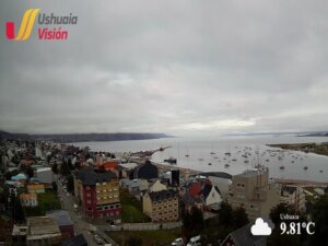
Ushuaia, Tierra del Fuego Province, Argentina
11.1°C / 52°F
19:46
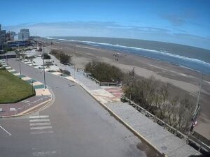

Torreón del Monje, Paseo Jesús de Galindez, Mar del Plata, Buenos Aires Province, Argentina
10.8°C / 51.4°F
19:46
The Tostado Webcam points at the white obelisk that stands at the center of Tostado, a town in the far northwest of Argentina’s Santa Fe province. The monument carries the town’s name down its shaft and sits at the edge of the main plaza, so the frame holds three things at once: the obelisk in the foreground, the plaza’s palms and conifers behind it, and the road that runs past on the right. A white church tower with a clock face rises above the treeline on the far side. Traffic is light and unhurried here, and the plaza fills and empties through the course of the day. This is a slow camera rather than a busy one, and the interest is in watching a small provincial town go about an ordinary afternoon.
Tostado sits 334 kilometers (208 miles) northwest of the provincial capital, Santa Fe, and roughly 480 kilometers (298 miles) from Rosario. It is the head town of the Nueve de Julio Department and lies close to two provincial borders: Chaco begins to the north, Santiago del Estero to the west. The land here is flat in every direction. The town stands at just 64 meters (210 feet) above sea level, which is why the obelisk and the church tower are the tallest objects anywhere in the camera’s view.
The settlement was founded on 5 November 1891 and was declared a city on 31 December 1970. At the 2022 national census it counted 17,009 residents, an increase of 8.9 percent on the 15,533 recorded in 2010. The name comes from the town’s coat of arms, which carries a tostado horse. The department itself is named for 9 July 1816, the date of Argentina’s declaration of independence.
Tostado is a junction more than a destination. National Routes 95 and 98 meet here, along with a set of provincial roads, and the Belgrano railway line runs through the town. The surrounding country is the Chaco region of Santa Fe, where cotton and sorghum are grown, hardwood is still cut from the remaining quebracho stands, and Zebu cattle are raised for their tolerance of heat and long dry spells. Out to the east and north the ground drops into the Bajos Submeridionales, a broad low-lying belt whose poor drainage turns into shallow channels, lagoons and flooded grassland whenever the rain runs heavy.
The climate is subtropical with a dry season. Summer runs from December to February and is genuinely hot: average maximum temperatures sit around 28 C (82 F), and the highest reading on record for the town is 46 C (115 F). Summer is also the wetter half of the year, so storm cloud can build quickly over that flat horizon, the light goes gray in minutes, and the plaza clears. Average relative humidity across the year is about 65 percent, falling to roughly 60 percent in January.
Winter is mild by most standards. Average winter minimum temperatures sit near 13 C (55 F) and the lowest figure ever recorded is 0.8 C (33 F), so hard frost is rare and the plaza palms stay green through July. Winter is the drier season, and relative humidity climbs to around 70 percent. Autumn is comparatively warmer than spring in this part of Santa Fe, which means the most even light on the camera tends to come in March and April. In early spring a pink flowering tree comes into bloom beside the plaza path, and for a few weeks it carries the strongest color anywhere in the frame.
Almost everything worth seeing in Tostado sits within a few blocks of the plaza the camera overlooks. The Museo Regional occupies buildings that once belonged to the Regimiento VI de Caballeria, the cavalry regiment posted here when this was still frontier country. Close by stands the historic mangrullo, a timber lookout tower of the type once used to watch for movement across the flat scrub in the years before the railway arrived.
For anything outdoors, the municipal campsite on the Rio Salado gives the town its one stretch of shaded riverbank and is where local families go in the heat. The wider draw is the Bajos Submeridionales itself, a wetland belt of shallow channels and seasonal lagoons spreading east and north across the plain. Tostado also works well as a staging post for a longer drive. National Route 95 runs north into Chaco province and south toward San Cristobal, while National Route 98 heads southeast, which makes the town a practical overnight stop between the Chaco and the river cities of southern Santa Fe.
If this corner of northern Argentina holds your attention, these three cameras are the natural next stops.
Tostado is in the northwest of Santa Fe province, Argentina, 334 kilometers (208 miles) northwest of the city of Santa Fe and about 480 kilometers (298 miles) from Rosario. It is the head town of the Nueve de Julio Department, with Chaco province to the north and Santiago del Estero to the west.
The camera frames the town’s white obelisk, which carries the name Tostado down its shaft, with the central plaza and its palms behind it and a street running across the right of the picture. A church tower with a clock face is visible above the trees on the far side of the plaza.
The climate is subtropical with a dry season. Summer average maximum temperatures are around 28 C (82 F), with a record high of 46 C (115 F), and summer is the wetter part of the year. Winter average minimum temperatures are near 13 C (55 F), and the record low is 0.8 C (33 F).
It is an obelisk standing at the edge of the town’s central plaza, with the letters of the town’s name running vertically down the white shaft. It sits on a low stepped base at a road corner.
The 2022 national census counted 17,009 residents, up 8.9 percent from the 15,533 recorded in the 2010 census.
The town sits at about 64 meters (210 feet). The surrounding plain is flat enough that nothing in the camera’s view rises above the local treeline except the obelisk and the church tower.
National Route 95 and National Route 98 meet in the town, together with several provincial roads, and the Belgrano railway line passes through. Route 95 runs north into Chaco province and south toward San Cristobal.
Autumn and winter, roughly April to September, are the more comfortable months, with drier conditions and temperatures well clear of the summer extremes.
Source: Canal oficial de CTTPLAY
The best new live webcams and site features, once a week.
By subscribing you agree to receive our weekly email. Unsubscribe any time.
 11.2°C / 52.2°F
 33.4°C / 92.1°F