Live

 00:37:47
 3.7°C / 38.7°F
 Few Clouds
 77%
77% 4 km/h / 2 mph
 07:09
07:09 18:14
18:14Loading forecast…
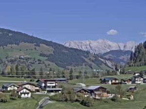
The Kirchberg am Wechsel Webcam is the market town’s own panorama camera, looking north across the rooftops of Kirchberg am Wechsel in Lower Austria from a meadow on the slope south of the town. A band of mixed woodland fills the foreground, the houses spread along the valley floor behind it, and the church of St. Wolfgang sits alone on its hill to the right under a steep red roof. Forested ridges climb behind the town, broken by open hay meadows, and on a clear day a higher, bare-topped summit shows on the far horizon. The picture changes most with the seasons: deep green from late spring, yellow and copper in the broadleaf trees by October, and white roofs and fields after a good winter snowfall.
Kirchberg am Wechsel is a market town of 2,507 people (January 2026) in the Neunkirchen district of Lower Austria, about 100 kilometers (62 miles) south of Vienna. It lies at 581 meters (1,906 feet) in the valley of the Otterbach, which joins the Molzbach at the east end of the town to form the Feistritz. The Wechsel range that gives the town its name rises to the south, behind the camera, so the mountain itself never appears in this view. The municipality covers 51.17 square kilometers (19.76 square miles), and about 68 percent of it is forest, which is why trees close in on almost every edge of the frame. The camera belongs to the Marktgemeinde, the town council, and is streamed by kechit GmbH with support from local sponsors.
The town’s name first appears in a document from 1232, spelled Kyperk, and it was already called a market by 1386. In 1216 the lords of Kranichberg laid the foundation stone of an Augustinian convent here. The building took its present form in 1657, was dissolved under Joseph II in 1782 and has been used by Dominican sisters as a spiritual center since 1999. With the parish church of St. James, rebuilt in Baroque style between 1754 and 1756, and the rectory, it forms the group of buildings at the heart of the market, and the white church tower near the middle of the picture marks that spot.
Local legend credits the founding of St. Wolfgang, the church on the hill to the right, to Saint Wolfgang himself around 970. It is recorded as a chapel in 1404, lost its consecration in 1782 and was rebuilt between 1859 and 1868. Lightning burned it out in 1918, and it was restored once more.
Winters in the valley are cold. January days typically reach about 1 C (34 F), and nights drop to around -6 C (21 F). Snow can turn the meadow in front of the Kirchberg am Wechsel Webcam and the town’s roofs white, and Kirchberg runs two small family ski lifts for those weeks. April afternoons reach about 13 C (56 F), and the hay meadows on the far slopes green up through May.
Summer is mild and the wettest part of the year. July afternoons are typically 24 to 25 C (75 to 77 F), with nights around 14 to 15 C (57 to 59 F), and from May to September rainfall runs at roughly 100 to 115 millimeters (3.9 to 4.5 inches) a month, against about 50 millimeters (2 inches) in midwinter. October afternoons sit around 15 C (59 F).
The Hermannshohle, in the Eulenberg hill just northwest of the town, is the largest dripstone cave in Lower Austria. Its passages run for 4,277 meters (about 2.7 miles) across 73 meters (240 feet) of height in a maze of interlinked levels, and it has been a show cave since 1844. The air stays at about 7 C (45 F) all year, so a jacket is worth bringing even in August. It is also the most bat-rich cave in Austria, with 17 species recorded and around 3,000 bats wintering inside, most of them lesser horseshoe bats.
Above the town, the wooden Kernstockwarte lookout tower stands on the Wolfenkogel. Back in the market, the plague column on the main square recalls the outbreaks of 1713 and 1714, and a linden said to be 1,000 years old is protected as a natural monument. To the south, the Steyersberger Schwaig mountain inn is a common starting point for the walk up the Wechsel, which forms about 15 kilometers (9.3 miles) of the border between Lower Austria and Styria. Its highest point, the Hochwechsel, reaches 1,743 meters (5,719 feet), with the Austrian Alpine Club’s Wetterkoglerhaus on the summit. In the first half of August the town hosts the International Wittgenstein Symposium, a philosophy conference held here every summer since 1976.
More Austrian views, from nearby Semmering to Vienna and the Zillertal in Tyrol:
Kirchberg am Wechsel is in the Neunkirchen district of Lower Austria, about 100 kilometers (62 miles) south of Vienna. It sits in the Otterbach valley at the northern foot of the Wechsel, the range that marks the border with Styria.
The camera looks roughly north from a meadow above the south side of the town. Trees fill the foreground, the houses of the market spread across the valley floor, a white church tower stands near the center, and St. Wolfgang church sits on its hill to the right. Forested ridges fill the background, with a higher summit on the horizon in clear weather.
No. The Steyersberger Schwaig mountain inn stands about 7 kilometers (4.3 miles) southwest of the town center on the slopes of the Wechsel, and the Hochwechsel summit lies further south still. Both are behind this camera, which faces away from the range and over the town.
Winters are cold, with January days around 1 C (34 F) and nights near -6 C (21 F). Summers are mild, with July afternoons of 24 to 25 C (75 to 77 F), and May to September is the wettest stretch of the year. The Kirchberg am Wechsel Webcam is the quickest way to see whether there is snow on the ground.
The town lies at 581 meters (1,906 feet) above sea level. The Wechsel to the south climbs to 1,743 meters (5,719 feet) at the Hochwechsel, about 1,160 meters (3,810 feet) higher.
Yes. The Hermannshohle, a show cave since 1844, lies in the Eulenberg hill just northwest of the town, and the temperature inside stays near 7 C (45 F) all year.
Yes, on a small scale. The town has two family-friendly ski lifts, and more ski areas sit on the Wechsel, among them neighboring St. Corona am Wechsel and Monichkirchen-Mariensee.
Source: kechit GmbH for the Marktgemeinde Kirchberg am Wechsel
The best new live webcams and site features, once a week.
By subscribing you agree to receive our weekly email. Unsubscribe any time.
 5.4°C / 41.7°F
 4.3°C / 39.7°F





 1.8°C / 35.2°F

