
Live
Kappa Bridge, Kamikochi, Japan
Kappa Bridge, Kamikochi, Kamikochi Azumi, Matsumoto, Nagano, Japan
 7.6°C / 45.7°F
 03:13
 03:13:45
 27°C / 80.6°F
 Clear Sky
 82%
 15 km/h / 9 mph
 06:30
 17:57
Loading forecast…
Kappa Bridge, Kamikochi, Kamikochi Azumi, Matsumoto, Nagano, Japan
7.6°C / 45.7°F
03:13



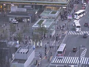
Hakata Station, 中央街-1 博多駅 Hakata Ward, Fukuoka, Japan
 24°C / 75.2°F
03:13

Planes on the ground and in the air within about 22 km (14 miles) of the airport, updated every 10 seconds. Tap a plane or a flight in the list for its details. Altitudes are above sea level. Positions come from volunteer ADS-B receivers, so some airports show few or no planes on the ground.
The Naha Airport Webcam looks down from the terminal at Naha Airport (OKA), Okinawa’s main gateway, across a busy apron of domestic jets. The curve of the terminal roof fills the bottom left corner, the boarding piers and jet bridges run across the middle of the frame, and beyond them the control tower stands over the runways with the sea on the horizon. Japan Airlines, Japan Transocean Air, ANA, Skymark and Jetstar aircraft rotate through the gates all day, and tugs, baggage carts and fuel trucks work around them between flights. The picture changes quickly. A rain squall can darken the whole apron in minutes and leave the concrete shining, and at dusk the floodlights come on while the sky over the sea turns orange.
Naha Airport sits on the western edge of Naha, about 4 kilometers (2.5 miles) west of city hall and only 3 meters (9.8 feet) above sea level. It is owned and run by the Ministry of Land, Infrastructure, Transport and Tourism, and it shares its runways with the Japan Air Self-Defense Force, whose Naha Air Base occupies the far side of the field. In 2024 the airport handled 21,705,234 passengers, enough to make it the sixth busiest in Japan, and the Haneda to Naha route is the third busiest air route in the country.
For decades a single 3,000 meter (9,843 foot) runway carried all of that traffic. A second runway of 2,700 meters (8,858 feet) opened on March 26, 2020, built on a 160 hectare (400 acre) artificial island in the sea west of the original one. The terminals grew in stages too: the domestic terminal opened in 1999, the international terminal in 2014, and a connecting building joining the two was completed in 2019.
The aircraft on screen tell you where you are. Japan Transocean Air is the Okinawa based arm of the JAL group, and one of its Boeing 737s wears the Jimbee Jet livery, a blue whale shark painted along the fuselage in a collaboration with the Okinawa Churaumi Aquarium. A pink twin, the Sakura Jimbee, flies alongside it. Either one parked at a gate is the most Okinawan thing the camera can catch.
Naha is subtropical and warm all year. The Japan Meteorological Agency’s 1991 to 2020 normals put January, the coolest month, at a daytime average of 19.8 C (67.6 F) and a night low of 14.9 C (58.8 F), so winter on the Naha Airport Webcam looks more like a mild spring day elsewhere in Japan. July and August average highs near 31.9 C (89.4 F), with nights that barely dip below 27 C (80.6 F).
Rain is the other constant. The year totals 2,161 millimeters (85.1 inches). The rainy season normally starts around May 10 and ends around June 21, and June is the wettest month at 284.4 millimeters (11.2 inches). On a wet day the apron turns dark and glossy, with jets and ground vehicles reflected in standing water. Late summer and autumn bring typhoons. An approaching storm can ground flights for a day or more, and the live picture is a quick way to check whether aircraft are still moving.
The best place to watch the same aircraft in person is Senaga Island, 15 minutes south of the airport by car and connected to the main island by road. The island is only 1.5 kilometers (0.9 miles) around, and its Observation Plaza is a favorite spot for watching aircraft take off and land. Senagajima Umikaji Terrace, a white terraced complex of cafes and shops, faces the sunset, and a hot spring on the island looks out over both the sea and the runway. Inside the airport itself, the domestic terminal has a free observation deck.
Central Naha is close. The Yui Rail monorail starts at Naha Airport Station and runs 17 kilometers (11 miles) through 19 stations to Tedako-Uranishi, a 37 minute ride end to end. Kokusai-dori, the 1.6 kilometer (1 mile) main street nicknamed the Miracle Mile for how quickly it was rebuilt after the war, runs from the Prefectural Office to the Asato intersection and closes to cars on Sundays from noon to 6pm. Just off it, the Daiichi Makishi Public Market has traded since 1950 and reopened in a new building in March 2023. Naminoue Beach, the only swimming beach in Naha, sits below Naminoue Shrine on its raised coral cliff about 10 minutes from the airport. Shuri Castle, part of a UNESCO World Heritage listing since 2000, lost its main hall to fire on October 31, 2019, and the rebuilt hall is due to reopen in late 2026. For open water, high speed boats leave Tomari Port for the Kerama Islands: 35 minutes to Tokashiki and about an hour to Zamami.
Another view of Okinawa, and the airports at both ends of Naha’s busiest routes.
On the west coast of Okinawa Island, in Naha, the capital of Okinawa Prefecture in southern Japan. The airport is about 4 kilometers (2.5 miles) west of Naha city hall, and the Yui Rail monorail links its terminal to the city center.
The domestic apron seen from the terminal: aircraft at the jet bridges, ground vehicles, the taxiways and runways, the control tower and the hangars on the far side, with the East China Sea on the horizon. Arrivals and departures cross the back of the frame on the runways.
The gates in frame are mostly used by Japan Airlines and its Okinawa subsidiary Japan Transocean Air, ANA, Skymark and Jetstar.
Warm and humid year round. Average highs run from 19.8 C (67.6 F) in January to about 31.9 C (89.4 F) in July, and the rainy season normally lasts from around May 10 to June 21.
The original runway, 18L/36R, is 3,000 meters (9,843 feet) long. The second runway, 18R/36L, is 2,700 meters (8,858 feet) and opened on March 26, 2020 on reclaimed land offshore.
Yes. The domestic terminal has a free observation deck facing the apron. For planes passing close overhead, Senaga Island just south of the airport is the local favorite.
Take the Yui Rail monorail from Naha Airport Station, the western end of the line, to Prefectural Office Station at one end of Kokusai-dori, or to Makishi Station further along. By car the street is about 15 minutes from the airport.
Source: RBC News
The best new live webcams and site features, once a week.
By subscribing you agree to receive our weekly email. Unsubscribe any time.
 20.4°C / 68.7°F